The Arapaho Arrive: Two Nations on One Reservation
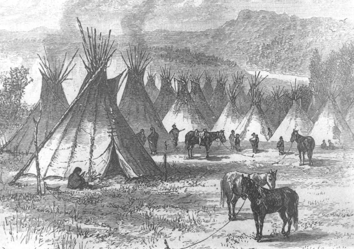
In the spring of 1878, about 950 Northern Arapaho people arrived with an Army escort on the Eastern Shoshone Reservation in the Wind River Valley in central Wyoming Territory. The two tribes had been in open warfare as recently as four years before, and bad feelings lingered between them.
Ten years earlier, in 1868, the U.S. government had promised the Northern Arapaho a reservation of their own. Some Northern Arapaho at that time had agreed, reluctantly, that they might be willing to settle in one of three places: on the Missouri River with the Lakota Sioux, on the Yellowstone with the Crow or in Indian Territory—present Oklahoma—with their southern Cheyenne and Arapaho relatives.
Neither locating with their old enemies, the Crow, nor with the Lakota, who were much more numerous and powerful, held much attraction for the Arapaho, however. And Indian Territory was hot, flat and too far from the country of the northern plains and mountains that the Northern Arapaho knew best.
Traders since earliest times, they had always moved about more than many other Plains tribes. In the years after the Treaty of Fort Laramie of 1868, they kept moving, while the Army and the government, busy with other questions, left the question of an Arapaho homeland unresolved.
It would remain unresolved for ten more years, until the government located the Northern Arapaho a reservation guaranteed earlier exclusively to the Shoshone. Members of both tribes still reside on the Wind River Reservation, as the reservation was officially renamed in the 1930s.
Life on the northern plains
Ethnohistorians say the Arapaho people, under pressure from the north and east, moved out of northern plains and woodlands and crossed the Missouri River sometime in the mid-1700s, though Arapaho tradition places this event much earlier.
By 1806, white chroniclers recorded Arapaho people as far south as the Arkansas River in present southern Colorado; by the 18-teens, southern bands had congregated in that region, while northern Arapaho bands were ranging north from the mountain parks of Colorado, west of modern places like Fort Collins and Boulder. Northern Arapaho elders who live on the Wind River Reservation today say they still regard those parts of the northern Colorado plains and mountains as their spiritual and historic homeland.[1]
When Fort Laramie on the North Platte River and Bent’s Fort on the Arkansas were established in the 1830s along the Rocky Mountain Front, Arapaho and Cheyenne people began trading at the forts. North-south divisions within the two tribes became more permanent: Northern Arapaho and Northern Cheyenne traded at Fort Laramie; Southern Arapaho and Southern Cheyenne traded at Bent’s Fort, in what is now southeastern Colorado.
In the 1840s, emigrant travel to Oregon, Utah and California swelled from a trickle to a flood. The Oregon Trail up the Platte, North Platte and Sweetwater rivers to the Continental Divide passed through the middle of northern Arapaho ranges and quickly began changing their lives. By the middle of the decade, it was already clear that emigrants and their livestock were to blame for the shrinking buffalo herds. Arapaho people told traveler and writer Lewis Garrard that “the white man was bad, that he ran the buffalo out of the country and starved the Arapahoes.” As resources dwindled, conflict and warfare among the plains tribes rose sharply.
Then gold was discovered in California and trails traffic swelled by a factor of ten. With the buffalo more scattered, the tribes needed horses more than ever. Lakota, Cheyenne and Arapaho warriors began raiding the trails, especially for horses and mules.
Hoping to avoid conflict, yet at the same time aware the West was far too large to be militarily controlled, government officials decided it was time to make a treaty with the tribes of the northern plains.[2]
Arapahos and the Fort Laramie Treaty of 1851
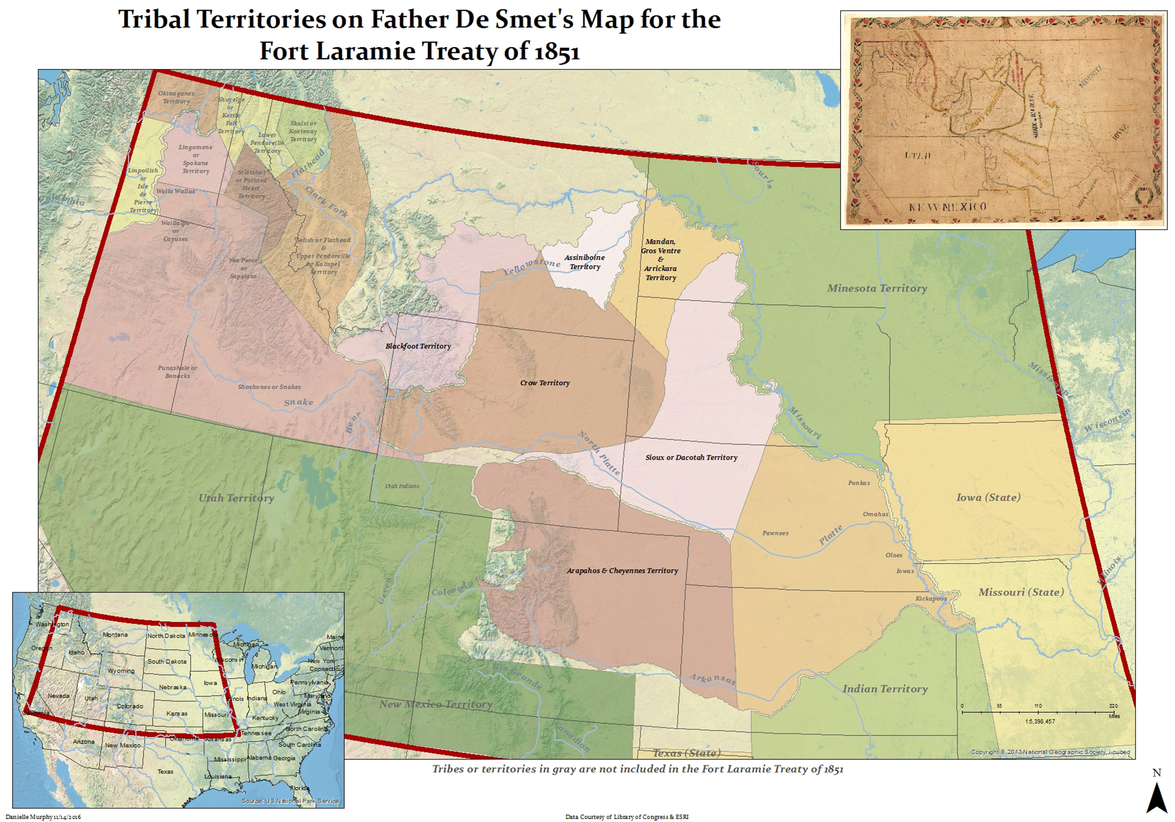
In September 1851, about 10,000 Indians gathered near Fort Laramie to negotiate. Under the treaty signed that month, the tribes of the northern plains would allow the United States to establish Army posts and make roads through Indian territory. They also agreed to the government’s proposal to assign specific lands to specific tribes, as shown on a map drawn at the time by the Jesuit Catholic missionary Father P.J. de Smet. Tribes were allowed to live and hunt wherever they liked—on their lands or others—as long as they remained peaceful.
Lands north of the Arkansas River, east of the Continental Divide and south of the North Platte River were assigned jointly to the Arapaho and Cheyenne. (See map). This included most of what is now eastern Colorado plus large parts of southeastern Wyoming, western Nebraska and western Kansas.
In return, the government promised the tribes annual payments of $50,000 in goods, for 50 years. The U.S. Senate ratified the treaty in 1852, the year following the signing, but with an important amendment. The payments—annuities, they were called—would last only ten years, or 15 if the president chose to extend the term.[3]
Already, that is, the government seemed not to be taking the treaty seriously. War broke out between the Army and the Lakota just three years later.
A gold strike
In 1858, prospectors found gold near what is now Denver, right in the middle of the lands allocated to the Arapaho and Cheyenne by the Fort Laramie treaty. Within three years, 100,000 or more gold seekers and other whites poured in to what soon became Colorado Territory. Along the trails, conflict grew and intensified.
This influx of newcomers widened the old geographical divisions between northern and southern bands of Arapaho and Cheyenne people. Northern bands moved from the Colorado Front Range to the plains north of the North Platte River. Others stayed south, toward the Arkansas.
A treaty for the southern Cheyenne and Arapaho
In 1861, representatives of some of the southern bands signed a treaty at Fort Wise on the Arkansas ceding all the land promised them in 1851 in exchange for a small reservation between the Arkansas and a nearby tributary, Sand Creek. Many other Cheyenne and Arapaho people complained at the time that only a minority of chiefs had signed, however, and that many of them did not understand what they were signing. No Northern Arapaho chiefs signed the treaty.[4]
Sand Creek, more raids and an Army campaign
Late in 1864, Colorado troops massacred around 200 people, most of them women and children, in a peaceful Cheyenne and Arapaho village on Sand Creek. Shocked and angry, Cheyenne, Arapaho and Lakota people began making war in earnest along the trails.
In the winter and spring of 1865, southern bands moved north to the Powder River Basin of what's now Wyoming and Montana, still rich in buffalo. That July they attacked the Army post at Platte Bridge on the North Platte River; two dozen soldiers were killed that day.
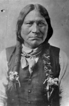
By this time, there were three main bands of what would become known as the Northern Arapaho. Friday, a leader who had learned English in his youth, led an Arapaho band in the Cache la Poudre country around what is now Fort Collins, in northern Colorado. Medicine Man was a longtime leader of a group on the North Platte and Sweetwater ranges, where the buffalo hunting was good. His group sometimes came into conflict with Eastern Shoshone bands. Arapaho people led by Black Bear married frequently among the Lakota and ranged in the Powder River Basin, from the North Platte to the Bighorns and east to the Black Hills. As hostilities increased, most of Friday’s people joined the other two bands.[5]
In August 1865 the Army mounted a large campaign; one brigade attacked Black Bear’s band in a village in the Powder River Country. The attack devastated the Northern Arapaho. They were a small tribe of only 180 lodges—perhaps 1,100 people in all the bands combined, at a time when smallpox and cholera were also spreading among them. After the attack, the Northern Arapaho could no longer raise large war parties.[6]
Red Cloud’s War and a second Fort Laramie Treaty
Warfare continued to increase, especially along the Bozeman Trail, a new route from the Oregon Trail through the Powder River Basin to gold fields in Montana. The troubles came to be called Red Cloud’s war, after the Oglala Lakota war leader; Capt. William Fetterman and his 80-man command were all killed in December 1866. Another fight nearby ended in a draw the following summer.
In the East, in the wake of the Sand Creek massacre and now the Fetterman fight, a peace faction had begun to emerge in Congress. The West, crisscrossed by stage lines, freight caravans, steamboat traffic on the Missouri and now a fast-building transcontinental railroad, was changing fast.
Early in 1868, government peace commissioners contacted the warring tribes. Commissioners paid Friday $315 to contact the Northern Arapaho bands with a clear ultimatum: Sign a treaty or there would be no more provisions.[7]On May 10, 1868, 150 lodges of Northern Cheyenne and Northern Arapaho met the commissioners at Fort Laramie to sign a treaty.
Signing for the Northern Arapaho were Medicine Man, Black Bear, Little Wolf, Littleshield and Sorrel Horse. Spotted Tail signed for the Brule Lakota, but no other important Lakota leaders signed that spring and summer. Finally, in November, the Oglala Lakota leaders signed the document as well.
A large reservation for the Lakota would be set aside on the west side of the Missouri River in Dakota Territory—the western half of present South Dakota—and the tribes, including the Arapaho, could continue to hunt in the Powder River Basin.
The Arapaho agreed to settle within a year at one of three places: on the Missouri with the Lakotas, on the Yellowstone River in Montana Territory with the Crows or in Indian Territory—present Oklahoma—with their southern Cheyenne and Arapaho relatives.
This time, the government agreed to provide annuity goods for 30 years, plus schools, farm equipment and rations for Indians who settled permanently on the reservations.
But the Northern Arapaho, who disliked all three reservation alternatives offered them, continued to hope the government would find them a reservation of their own.[8]
The Shoshone Reservation
Also in the 1860s, the U.S. government negotiated two treaties with the Eastern Shoshone people that resulted in their coming to live in Warm Valley—the valley of the Big Wind River and its tributaries—in what is now west-central Wyoming,
The first treaty, signed in 1863, outlined a sprawling Eastern Shoshone homeland of around 44 million acres on both sides of the Continental Divide. The second treaty, signed in 1868, shrank this to a far smaller reservation of around 3.2 million acres, with its heart in the Wind River Valley. The new reservation, according to the treaty, was established “for the absolute and undisturbed use and occupation of the Shoshone Indians herein named …”
And in 1867, meanwhile, gold was discovered near South Pass, near the southern edge of what soon would become the reservation. Unlike most reservations, therefore, the new one at Wind River at the time it was established had far more white people than native people living on it year-round. One historian estimates as many as 5,000 people lived in the gold-mining camps around South Pass and in the Wind River Valley 40 miles north, where whites were beginning to raise crops and livestock to feed the miners.[9]
Eastern Shoshone bands continued to live and hunt widely for another year or two before moving to the new reservation year-round.
In 1869, the new Wyoming Territory’s first governor and Indian superintendent arrived in Cheyenne. John Campbell wanted the Eastern Shoshones to abandon their nomadic lives and settle on the reservation.
Washakie, the leader of the Eastern Shoshones, was reluctant to move too quickly, however. He insisted the Eastern Shoshones be allowed to continue their old pattern of summers on Wind River and winters at Fort Bridger, where they could continue to receive their annuity goods.
Arapahos head to Wind River—the first time
Meanwhile, Northern Arapaho band leaders Medicine Man and Black Bear continued to press the government for a solution. They suggested a possible reservation on the North Platte River in Wyoming Territory near the old Platte Bridge, where an Army post had recently been abandoned. Government agents suggested they instead join their ethnic cousins the Gros Ventres on Milk River in northern Montana Territory. One hundred sixty lodges of Arapaho people spent the winter of 1868-1869 there, but a smallpox outbreak sent them on their way again in the spring.
The Arapaho chiefs had their eyes on Wind River and were hoping for some kind of accommodation with the Eastern Shoshone, their traditional enemies. Looking for a solution, Gov. Campbell and U.S. Army Gen. Christopher Augur set up a meeting for Washakie with Arapaho leaders Friday, Medicine Man and Sorrel Horse for October 1869.
A skeptical Washakie
When the Arapahos arrived, however, Washakie was off hunting in the Bighorns, probably an indication of his doubts about Arapahos moving to Wind River. Four months later, in February 1870, Arapahos Medicine Man, Black Bear, Sorrel Horse, Little Wolf and Knock Knees came for a second meeting. This time, according to Arapaho tradition, the Shoshones agreed for the Arapahos to settle—temporarily—on Wind River. Many Shoshones today say there was no such agreement at that time.
Arapaho arrival and retreat
Northern Arapaho people began arriving in March. Soon, white settlers blamed them for Indian attacks that killed seven miners. On March 31 a mob of 250 white vigilantes, together with some Shoshones, attacked two groups of Arapaho moving from their camp on Wind River to trade in nearby Lander. About a dozen Arapahos were killed, including Black Bear.
Relations between the two tribes quickly deteriorated. The Arapaho began to leave. Medicine Man went to Fort Fetterman on the North Platte, and with the help of the trader and the post commander they convinced Territorial Gov. Campbell that Arapaho warriors had played no part in the recnt attacks on the miners.[10]
The Eastern Shoshone, meanwhile, drew their annuity goods on Wind River for the first time that fall of 1870. Indian agents on the new reservation—the job turned over frequently—did little to curb the activities of the white miners, farmers and stock raisers who were now living illegally on Indian land.
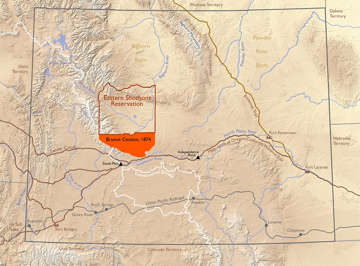
The Brunot Cession
At the same time, the agents and Gov. Campbell began considering the idea of detaching the southern third or so of the reservation.
Under the terms of the Brunot Cession, negotiated in 1872 and ratified by Congress in 1874, the Eastern Shoshone tribe gave up around 700,000 acres—the valley of the Popo Agie River and areas around the town of Miner’s Delight near South Pass. (See map.) In return, they received promises of $20,000 worth of cattle and $5,000 in cash, to be paid in annual installments over five years.
Cattle deliveries were slow in coming, however. And whites began taking up land in the ceded portions long before Congress finalized the deal. The local white economy began growing away from mining toward farming and ranching. The gold mines were about played out anyway. [11]
Northern Arapaho on the Move
By the winter of 1870-1871, the Northern Arapaho had left Wind River and were hunting in the Powder River Basin. Game was scarce, however. Friday’s band had joined the other Northern Arapahos by this time. With Friday as interpreter, the Arapaho leaders continued to cultivate friendships with Army officers, in hopes of winning their support for a new reservation.
In March 1871, Medicine Man, Friday, Littleshield and a new Arapaho leader named Black Coal agreed to draw their annuity goods with the Oglala Lakota at the Red Cloud Agency near Fort Laramie. But the Oglala treated them condescendingly. The Arapaho stayed out in the Powder River country as much as possible, despite the dwindling buffalo supply.
A raid on Trout Creek
At the same time, Lakota, Cheyenne and most likely some Arapaho warriors continued, from time to time, to raid white and Shoshone people on Wind River. In 1872, a large raiding party attacked a Shoshone camp on Trout Creek, near the Indian agency. Shoshones scouts knew the raiders were coming, however, and sent the women and children up into the foothills of the Wind River Range to the west, for safety. Then they dug rifle pits inside their lodges, rolled up the bottom edges of their tipis and thus were able to fire out at the approaching raiders from solid defensive positions. The raiders were driven off. “We like to think we chased them all the way to Casper,” meaning, where Casper is now, 150 miles to the east, Shoshone elder John Washakie says.[12]
In the summer of 1874, in apparent reprisal for Arapaho raids, about 160 Shoshone warriors—30 of them enlisted as Army scouts—plus 60 cavalry troopers under Capt. Alfred E. Bates from Camp Brown on the Wind River Reservation attacked an Arapaho village on what has since been named Bates Creek, in the mountains between the Bighorn and Wind River basins. Arapaho men managed to gather at the top of a cliff, fire down on the attackers and drive them off. But many of the lodges were destroyed, 200 horses were stolen and, the Army estimated later, about 24 Arapaho people were killed.[13]
Though the soldiers and Shoshone warriors counted the fight a victory, by further impoverishing the Northern Arapaho the battle led to a series of events that ended up limiting Shoshone control over the lands the Fort Bridger Treaty had guaranteed them back in 1868.
The loss of the Black Hills
By this time, the buffalo supply was shrinking fast, the old ways of the tribes were steadily becoming more difficult to sustain and the U.S. government was turning up the pressure.
In the summer of 1874, Lt. Col. George A. Custer led an expedition of 1,000 troops through the Black Hills of Dakota and Wyoming territories and found gold.
In 1875, the Oglala Lakotas relocated to a new Red Cloud Agency and the Brules to a new Spotted Tail Agency, both in northwestern Nebraska.
Northern Cheyenne and Northern Arapaho people, still lacking an agency or reservation of their own, mingled with the Oglalas at Red Cloud Agency. Rations there were poor, the annuity flour was so bad the Indians sold it for horse feed and some Arapaho children starved to death. Arapahos near Fort Fetterman killed and ate their horses and begged at the post.[14]
The next year, the government began pressing the Lakota to sell the Black Hills. Among the Oglala, Red Cloud and others were ready to sign; Crazy Horse stayed out in the Powder River country and refused. In 1876, Army campaigns against the resisters resulted in the death of Custer and 267 of his men that June at the Little Bighorn.
|
Government officials began pressing even harder on the tribes at the Red Cloud Agency for sale of the Black Hills. All were reluctant, but again it came down to an ultimatum: Sign or starve. Together with the Lakota and the Northern Cheyenne, the Northern Arapaho signed a document in September giving up their claims to the Black Hills. They agreed to settle with the Lakota near Fort Randall on the Missouri River in southern Dakota Territory —or to head south to Indian Territory.[15]
Shoshone and Arapaho scouts in the Great Sioux War
As the so-called Great Sioux War—of which Custer’s campaign was only a part—was conducted by the Army in 1876 in the Powder River Basin, meanwhile, young Shoshone men from their reservation and young Arapaho men from the Red Cloud Agency realized that scouting for the generals offered both an honorable occupation and food for their families.
About 120 Shoshone warriors, led by Wisha, Nawkee and Luishaw, joined Gen. George Crook as scouts in his drive that ended at the Battle of the Rosebud, shortly before the Custer disaster. The Shoshone scouts received Army rations; while they were away, their families drew food rations from Army stores at Camp Brown.
For their part, Arapaho leaders still hoped that by cultivating friendships with officers they might yet find Army support for a reservation of their own.
As a result, both Shoshone and Arapaho scouts, together with 100 Pawnees and a few Lakota, were all with Gen. Crook during a campaign in November 1876 when his troops attacked a large Cheyenne camp under Dull Knife on the headwaters of Powder River. The Army pursued the remaining Oglala and Cheyenne bands through the winter. The following spring, all came in to the Lakota agencies. The wars of the northern plains were essentially over.[16]
The Northern Arapahos, however, still had no reservation.
The Northern Arapaho arrival on Wind River
According to the Arapahos, Gen. Crook in 1877 agreed to help them find a reservation on Tongue River, near the northern end of the Powder River Basin. Nothing would come of that, but other Army officers also pushed for a place for them north of the North Platte.
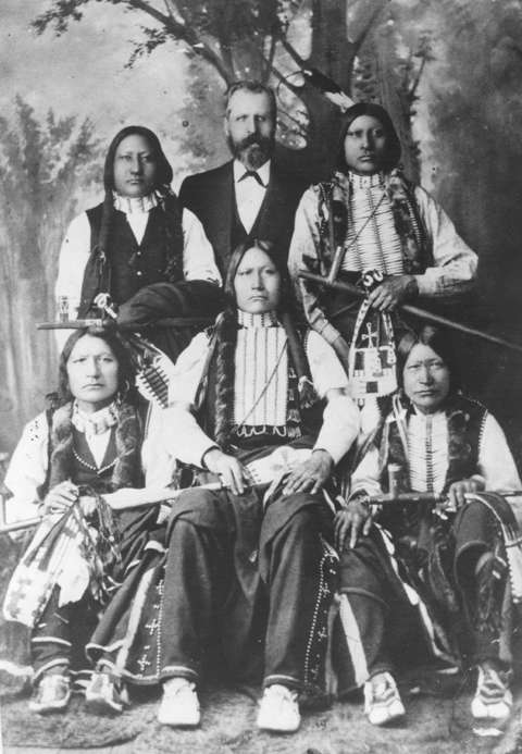
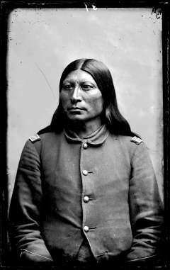
In September 1877, Friday, Black Coal, Sharp Nose and 16 Lakotas, including Red Cloud and Spotted Tail, traveled to Washington, D.C., to meet with President Rutherford B. Hayes and Interior Secretary Carl Schurz.
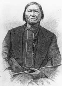
Black Coal made an eloquent plea for a home for the Northern Arapaho. “You ought to take pity on us and give us good land, so that we can remain upon it and call it our home,” he said to the president, the secretary and a group of Army officers.[17]
Hayes approved a temporary location for the Arapaho that winter on the Sweetwater—on the route they would need to travel from the Red Cloud Agency to Wind River. By this time, James Irwin, agent on Wind River at the time of the Brunot Cession, was now agent at the Red Cloud Agency. The Indian Bureau sent him to Wind River to talk with Washakie. According to Wind River Reservation farmer Fin Burnett, Shoshone leaders Washakie, Norkok, Wahwannabiddie, Moonhabe and Wesaw agreed to make peace with the Arapahos and to allow them a place—just temporarily—on their reservation.[18]
At Red Cloud Agency in Nebraska in the fall of 1877, the 950 or so Northern Arapahos were issued 155 cattle to feed them on their journey. They left Oct. 31. They arrived at Fort Fetterman on the North Platte on Nov. 13; by Nov. 18, they had killed and eaten all the cattle. Gen. Crook approved an issue of guns and ammunition to the men so that they could hunt. They continued moving and spent the coldest months of the winter near the Sweetwater-North Platte confluence, in the country around Independence Rock.
On March 18, 1878, 21 Arapaho lodges under Black Coal’s leadership arrived, with a military escort, on the Shoshone Reservation on Wind River and camped two days’ travel from the agency headquarters at Camp Brown.
Reluctantly, Shoshone Reservation Agent James Patten issued rations for the Arapaho. Within a few weeks, leaders of both tribes met informally. Patten reported the Shoshone continued to object, but were willing accept the Arapaho, for now. Both tribes continued to hope for a meeting with Gen. Crook—and a better solution. By May, most of the rest of the Arapaho had arrived on Wind River.[19]
“Thus began,” writes ethnohistorian Loretta Fowler about the Northern Arapaho, “a struggle to subsist on short rations, to counter the Shoshones’ efforts to have them removed, and to resist the government’s attempts to undermine tribal institutions.[20]” As for the Eastern Shoshones, they too faced a short food supply and government pressure against their traditions—and they were now forced to share their reservation with these newcomers, their enemies in warfare only a few years earlier, whether they liked it or not.

Resources
Primary sources
- “Treaty of Fort Laramie with the Sioux, etc.” In Indian Affairs: Laws and Treaties. Vol. 2, Treaties, editor and compiler Charles J. Kappler, 594-596, (Washington: Government Printing Office, 1904.) Accessed Dec. 8, 2017, at http://dc.library.okstate.edu/digital/collection/kapplers/id/19154/rec/1. This is the text of the 1851 treaty of Fort Laramie. Charles Kappler’s seven-volume compilation contains the texts of all treaties, laws and executive orders dealing with Indian tribes. Volume 2 includes the texts of U.S. government treaties and agreements with tribes from 1778 to 1883. Vols. 1 and 3-7 include laws and executive orders from 1871 through 1970. All are available on line at the digital collections at the Oklahoma State Library.
- “Treaty with the Eastern Band Shoshoni and Bannock, 1868.” In Indian Affairs: Laws and Treaties. Vol. 2, Treaties, editor and compiler Charles J. Kappler, 1020-1024. Washington: Government Printing Office, 1904. Accessed Dec. 8, 2017, at http://dc.library.okstate.edu/digital/collection/kapplers/id/20698/rec/1. Text of the 1868 Fort Bridger Treaty with the Eastern Shoshone and Bannock tribes.
- “Treaty with the Eastern Shoshoni, 1863.” In Indian Affairs: Laws and Treaties. Vol. 2, Treaties, editor and compiler Charles J. Kappler, 848-849. Washington: Government Printing Office, 1904. Accessed Dec. 8, 2017, at http://dc.library.okstate.edu/digital/collection/kapplers/id/20034/rec/1. Text of the 1863 Fort Bridger Treaty with the Eastern Shoshone tribe.
- “Treaty with the Shoshonee and Bannacks, July 3, 1868.” Posted on the Jackson Hole Historical Society and Museum’s website about the Wind River Reservation. Accessed Dec. 8, 2017, at http://jacksonholehistory.org/wp-content/uploads/1868-treaty.pdf. A more readable pdf version than the Kappler text, with added comment by historian Henry Stamm.
- “Treaty with the Sioux, Brule, Oglala, Miniconjou, Yanktonai, Hunkpapa, Blackfeet, Cuthead, Two Kettle, Sans Arcs, and Santee, and Arapaho, 1868.” In Indian Affairs: Laws and Treaties. Vol. 2, Treaties, editor and compiler Charles J. Kappler, 1003-1006. Washington: Government Printing Office, 1904. Accessed Dec. 8, 2017, at http://dc.library.okstate.edu/digital/collection/kapplers/id/20643. Text of the 1868 Fort Laramie Treaty.
- Washakie, John. Conversations and emails with WyoHistory.org Editor Tom Rea, spring 2018. John Washakie is a direct descendant of Chief Washakie.
- White, Nelson and Crawford. Conversations with WyoHistory.org editor Tom Rea, September, November 2017. Brothers Crawford and Nelson White are elders of the Northern Arapaho Tribe.
Secondary sources
- Drake, Kerry. “The Wagon Box Fight, 1867.” WyoHistory.org. Accessed June 10, 2018, at /encyclopedia/wagon-box-fight-1867.
- Flynn, Janet. Tribal Government: Wind River Reservation. 1991. Reprint, Lander, Wyo.: Mortimore Publishing, 2008. An extremely useful look at the history of government and leadership on the Wind River Reservation, with clear details on the treaties, agreements and lawsuits.
- Fowler, Loretta. Arapaho Politics, 1851-1978: Symbols in Crises of Authority. Lincoln, Neb.: University of Nebraska Press, 1982. An excellent ethnohistory of the Northern Arapaho people, with emphasis on their constantly evolving leadership and governance structures over time.
- “Friday, the Arapaho Interpreter.” Arapaho Legends, March 3, 2016. Accessed Dec. 4, 2017, at http://www.arapaholegends.com/friday-the-arapaho-interpreter/.
- More detail on the life of Friday, long time Arapaho leader and interpreter.
- Hein, Ellis. “The Battles of Platte Bridge and Red Buttes.” WyoHistory.org. Accessed Dec. 4, 2017, at /encyclopedia/battles-platte-bridge-station-and-red-buttes. This and the following detail important Indian fights and campaigns on the North Platte and Powder Rivers in 1865.
- ____________. “Connor’s Powder River Expedition of 1865.” WyoHistory.org. Accessed Dec. 4, 2017, at /encyclopedia/connors-powder-river-expedition-1865.
- Jackson Hole Historical Society and Museum. “An Introduction to Wind River Reservation.” Accessed Dec. 3, 2017, at http://jacksonholehistory.org/an-introduction-to-the-wind-river-indian-reservation-of-wyoming/. This website offers a wide range of articles and documents pertaining to the reservation, with more information on the Eastern Shoshone than the Northern Arapaho.
- Ostlind, Emilene. “Red Cloud’s War.” WyoHistory.org. Accessed Dec. 4, 2017, at /encyclopedia/red-clouds-war. An account of the conflicts along the Bozeman Trail, 1864-1868, which led from the North Platte through the heart of the Powder River Basin to the gold fields of Montana.
- Rea, Tom. “Gathering the Tribes: The Cheyennes Come Together after Sand Creek.” WyoHistory.org. Accessed Nov. 20, 2017, at /encyclopedia/gathering-tribes-cheyennes-come-together-after-sand-creek. Narrative based on Cheyenne mixed-blood George Bent’s account of the tribe’s move north into the Powder River Basin after the Sand Creek Massacre, 1864-1865.
- _________. “Peace, War, Land and a Funeral: The Fort Laramie Treaty of 1868.” WyoHistory.org. Accessed Dec. 8, 2017, at /encyclopedia/peace-war-land-and-funeral-fort-laramie-treaty-1868. Article takes the funeral of Mni-Akuwin, Spotted Tail’s daughter, as a place to begin telling the story of Lakota-white relationships surrounding the1868 Fort Laramie Treaty.
- Robinson, Gerry. “The Dull Knife Fight: Troops Attack a Cheyenne Village on the Red Fork of Powder River, 1876.” WyoHistory.org. Accessed Nov. 26, 2017, at /encyclopedia/dull-knife-fight-1876-troops-attack-cheyenne-village-red-fork-powder-river. An account of the fight on the Red Fork of Powder River in which the Northern Cheyennes suffered a defeat that led them to come in to the reservation the following spring. Author Gerry Robinson is an enrolled Northern Cheyenne.
- Smith, Shannon. “New Perspectives on the Fetterman Fight.” Accessed June 10, 2018,at /encyclopedia/new-perspectives-fetterman-fight.
- Stamm, Henry E. IV. People of the Wind River: The Eastern Shoshones, 1825-1900. Norman, Okla.: University of Oklahoma Press, 1999. A useful, reliable source on the Eastern Shoshones of the 19thcentury, with emphasis too on their relations with their white and Arapaho neighbors.
- Troyer, Michael D. “Treaty of Fort Wise.” Colorado Encyclopedia. Accessed Nov. 25, 2017, at https://coloradoencyclopedia.org/article/treaty-fort-wise. Details and background on the treaty in which some leaders of the Southern Cheyenne and Southern Arapaho tribes signed away all the land between the North Platte and Arkansas rivers for a much smaller reservation near Sand Creek.
- WyoHistory.org. “Coming to Wind River: the Eastern Shoshone Treaties of 1863 and 1868.” WyoHistory.org. Accessed June 10, 2018 at /encyclopedia/coming-wind-river-eastern-shoshone-treaties-1863-and-1868.
- Utley, Robert M. The Indian Frontier of the American West, 1846-1890. Albuquerque: University of New Mexico Press, 2003. Excellent source for the conflicts and treaties of the western plains in the second half of the 19thcentury, with valuable insights into the national politics and ideas of reform that informed the presidency, the Indian Bureau and the Army in their dealings with tribes.
- “Wind River Treaty Documents. Treaties and Agreements Between the Eastern Shoshones and the United States.” Jackson Hole Historical Society and Museum website on the Wind River Reservation. Includes commentary about and links to full texts of the Fort Bridger treaties of 1863 and 1868, plus the 1872 Brunot cession, the 1896 Big Horn Hot Springs cession and the Land cession of 1904. Accessed Dec. 12, 2017, at http://jacksonholehistory.org/wind-river-treaty-documents/.
- Wischmann, Lesley. “Separate Lands for Separate Tribes: The Fort Laramie Treaty of 1851.” Wyo History.org. Accessed Nov. 19, 2017, at /encyclopedia/horse-creek-treaty. Political events and historical context for the 1851 treaty at Fort Laramie.
Illustrations
- The photo of Sharp Nose in uniform is from the American Heritage Center at the University of Wyoming. Used with permission and thanks.
- All other photos are from the collections of the Wyoming State Archives in Cheyenne. Used with permission and thanks.
- The map showing Father de Smet’s original map and a contemporary map of the lands assigned tribes in the Fort Laramie Treaty of 1851 was prepared by former Casper College GIS student Danielle Murphy. Used with thanks.
- The map of the Brunot Cession was prepared by the Wyoming Geographic Information Science Center at the University of Wyoming. Special thanks to WyGISC and to Margo Berendsen, cartographer.
[1]“Arapaho elders … say they still regard…” Crawford and Nelson White conversations with WyoHistory.org editor Tom Rea, Fort Washakie, Wyo., September, November 2017.
[2]Loretta Fowler, Arapaho Politics, 1851-1978: Symbols in Crises of Authority, (Lincoln, Neb.: University of Nebraska Press, 1982), 15-24, “the white man was bad . . .”, 23
[3]Lesley Wischmann, “Separate Lands for Separate Tribes: The Fort Laramie Treaty of 1851,” WyoHistory.org; “Treaty of Fort Laramie with the Sioux, etc.” Indian Affairs: Laws and Treaties, Charles J. Kappler, editor. Vol. 2, Treaties, pp. 594-596.(Washington: Government Printing Office, 1904.)
[4]Michael D. Troyer. “Treaty of Fort Wise,” (Colorado Encyclopedia.) Accessed Nov. 25, 2017, at https://coloradoencyclopedia.org/article/treaty-fort-wise.
[5]Fowler, 43.
[6]Ellis Hein, “Connor’s Powder River Expedition of 1865,” WyoHistory.org, accessed June 11, 2018, at /encyclopedia/connor’s-powder-river-expedition-1865.
[7]Fowler, 46.
[8]Fowler, 46-47; “Treaty with the Sioux, Brule, Oglala, Miniconjou, Yanktonai, Hunkpapa, Blackfeet, Cuthead, Two Kettle, Sans Arcs, and Santee, and Arapaho, 1868.”Indian Affairs: Laws and Treaties. Vol. II, Treaties, pp. 1003-1006. Kappler, Charles J., editor and compiler.
[9]Fowler, 48.
[10]Henry E. Stamm, IV, People of the Wind River: The Eastern Shoshones, 1825-1900. (Norman, Okla.: University of Oklahoma Press), 1999, 57; Fowler, 47-48.
[11]Stamm, 57-59, 64, 74-82, 92-95; Janet Flynn, Tribal Government: Wind River Reservation, 1991. Reprint, (Lander, Wyo.: Mortimore Publishing), 2008, 33.
[12]WyoHistory.org Editor Tom Rea conversation with John Washakie, March 2018.
[13]Fowler, 50-52.
[14]Fowler, 53-56; Robert M. Utley, The Indian Frontier of the American West, 1846-1890. Albuquerque: University of New Mexico Press, 2003, 174.
[15]Fowler, 56-58; Stamm, 127.
[16]Fowler, 58-63; Stamm, 113-114. 128.
[17]Fowler, 65.
[18]Stamm, 129.
[19]Fowler, 63-67; Stamm, 128-129; John Washakie, email to WyoHitory.org Editor Tom Rea, June 13, 2018.
[20]Fowler, 67.