Mining the Absarokas
No landscape is beyond the reach of history. The wilderness of the Absaroka Mountains, bordering the west side of Wyoming’s Bighorn Basin, is no different. Evidence of early mining activity still endures in isolated pockets, and searchers can still find cabin ruins, tailings and a few crumbing tunnels.
Wyoming simply did not experience anywhere near the level of hard rock mining—primarily gold, silver and copper—as the Rocky Mountain states that surround it. Although gold production at South Pass City, Atlantic City and Miner’s Delight in Fremont County made for a lively chapter in Wyoming history, in the broad picture these were tiny booms and only remained small-scale operations.
Historians of mining have always, justifiably, focused on where mining most occurred. Different minerals made for very different economic cultures in our Rocky Mountain neighbors. Gold and silver first drew enough White people to Colorado and Idaho that both were territories by the time of the Civil War; gold and silver drew early miners to Montana, too—but it was copper that dominated Montana’s economy for more than a century. Copper is still a mainstay of Utah’s economic life. Wyoming miners and drillers, by contrast, extracted wealth from coal since earliest territorial times and from oil since the first years of statehood—but never much wealth from hardrock mining. What is also worth considering, in terms of Wyoming history, is how the lack of big hardrock booms in the state have affected our economy and environment into the present day.
Mining Booms
Gold, silver and copper discoveries of the late 19th and early 20th century produced a mining boom culture in the West characterized by unstable, restless and perpetually itinerant populations always on the lookout for the next big strike.
The mining at South Pass, while important to Wyoming’s territorial history, was small compared to those booms in neighboring states. But Wyoming’s location amid many surrounding booms pushed miners and prospectors from adjacent territories into unexplored places here.
 River is at upper right.")
Locating the Clarks Fork Mines
In the summer of 1870, a small party of prospectors entered the Absaroka Mountains from the west, traveling up the Yellowstone River from Montana Territory to the country around the Lamar River in what’s now northeastern Yellowstone Park. They climbed up into the mess of mountains at the head of the Clarks Fork of the Yellowstone and south to the head of the North Fork of the Shoshone River, Stinking Water as it was known then, around Hoodoo Basin at the convergence of the headwaters of the Lamar River, Crandall Creek, the North Fork of the Shoshone and Sunlight Creek.
While the men were prospecting the many streams and mountainsides around Hoodoo Basin, Indians ambushed their camp and drove away all their horses. The group escaped north over the Beartooth Mountains back into Montana Territory. But news of the area had finally gotten out.
When a return expedition was organized a few years later, Adam “Horn” Miller went to work on a vein of galena (lead) he had located on the earlier trip along the upper Clarks Fork. Other men struck out for new prospects. By early autumn when the snows drove the men out of the high country, several more claims had been discovered and staked.
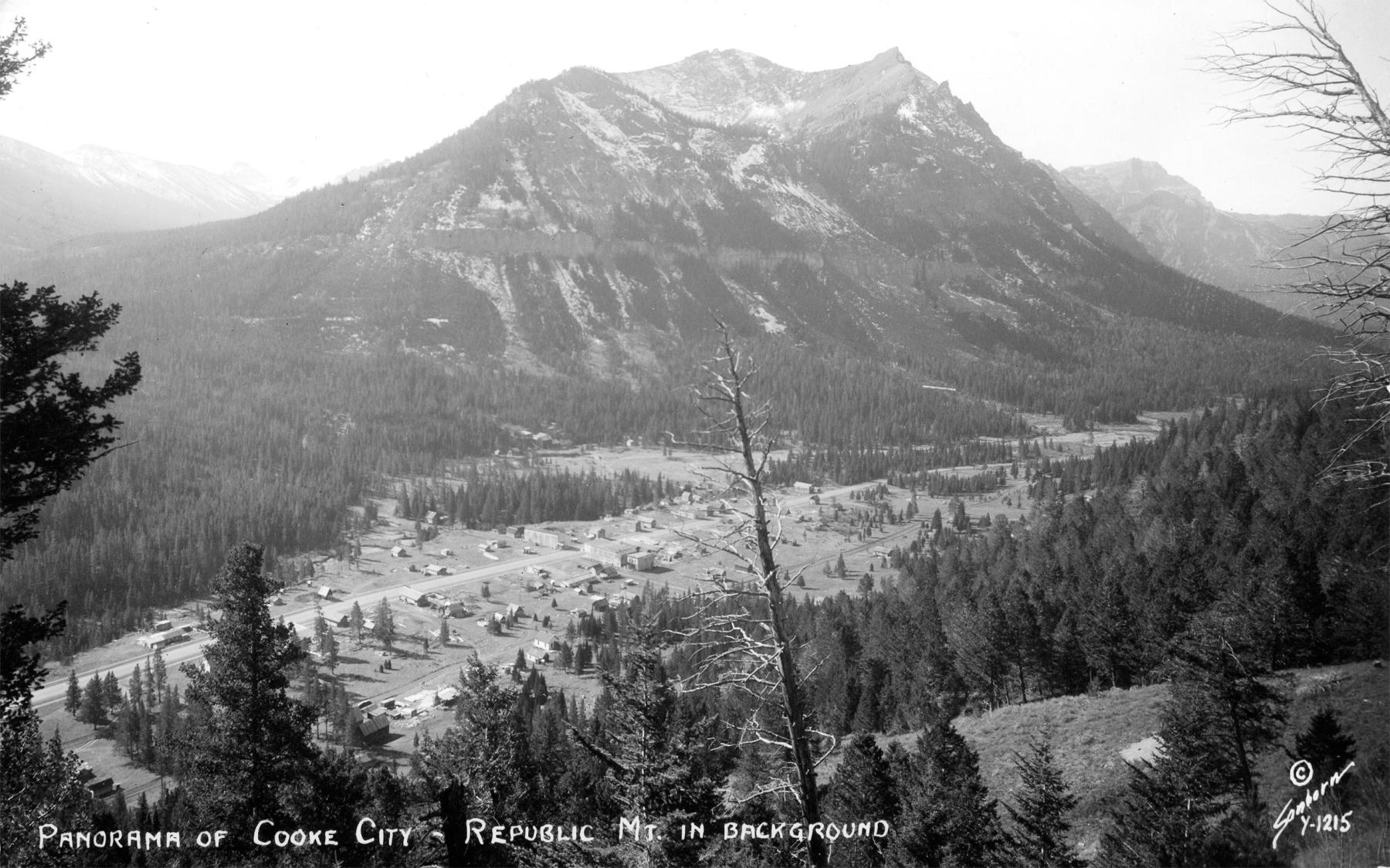
The New World Mining District was formed in 1872 and parties from Montana Territory began making their way into the region. Prospector Jack Baronett, built a wooden toll bridge across the Yellowstone River in 1871 to accommodate and capitalize on the anticipated traffic from Montana into the area. The Bozeman Avant Courier reported that some men “had already located rich quartz ledges, which they will proceed to develop, while others go to prospect the country. We think we are safe in saying that a camp of several hundred men will be established in that district the coming summer.” The miners built a primitive camp that initially had various names: Miner’s Camp, Clark Fork City, Edelweiss and Shoo Fly.
Because the minerals were located on what was then still part of the Crow Reservation, which included most of south central Montana Territory, miners could legally perform little development work. In 1882 the government substantially shrank the reservation, opening much of the Beartooth Mountains to mining. Very soon, prospectors had staked more than 1,450 claims in the New World District. They constructed two smelters to process gold, silver, copper and lead ore.
Investors started circling. The camp was soon named after Jay Cooke, mining investor, railroad man and influential capitalist from Ohio. By shamelessly using Cooke’s name, the miners anticipated a great deal of development, and perhaps a railroad, funded by the eponymous investor.
But what really plagued Cooke City was its remote location. Long distance to transportation hubs plus deep and long-lasting snows limited growth. Although miners found good ore, monumental shipping costs negated any profits. The railroad never arrived.
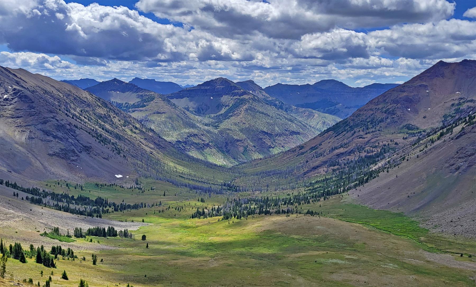
Mining in Sunlight Basin
Originally called the Telluride Mining District, the area around Sunlight Peak and Stinking Water Peak northwest of present Cody, Wyoming near the headwaters of Sulphur Creek, Sunlight Creek and the North Fork of the Shoshone, was once scattered with mining claims. Prospectors worked their claims in the season but couldn’t excavate lodes or haul ore on the long pack trails out of the mountains.
In 1895 John Painter of Philadelphia came west for a hunting trip in the Absarokas. Painter was an importer of Swiss music boxes; evidently a lucrative business. After Painter arrived by train at Red Lodge, Montana, his hired guide took the party up the Clarks Fork and into the mountains along the eastern boundaries of Yellowstone National Park. At some point they must have encountered some prospectors at work on their claims, who pitched them on the area’s potential.
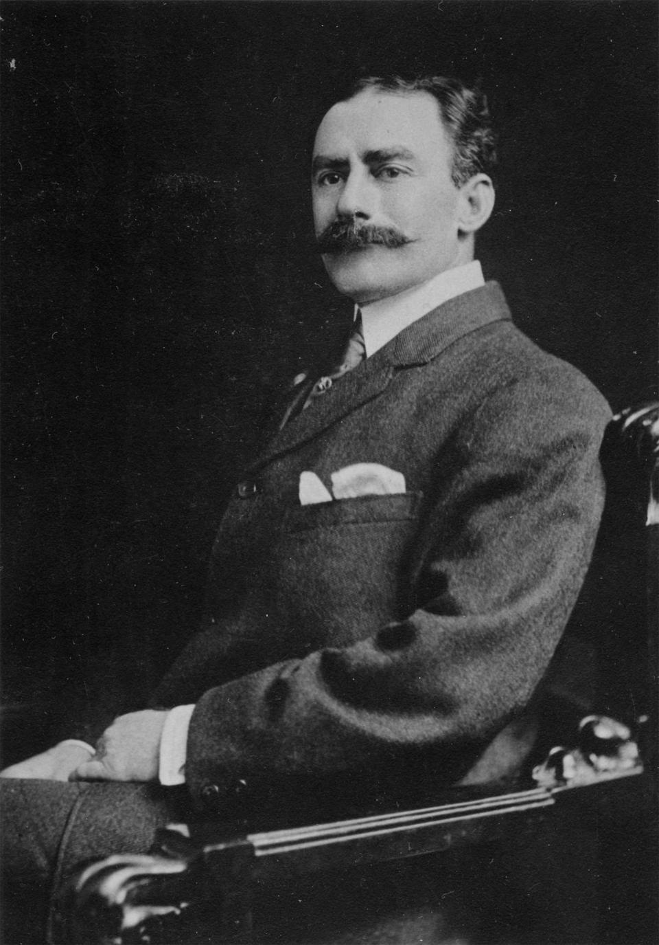
Painter returned for a few summers to purchase a few mines and locate his own claims before selling his Philadelphia business and, in 1901, permanently moving his family to Sunlight Basin, in what’s now northwestern Park County, Wyoming.
Painter began contracting with local miners to drive tunnels into the Morning Star and Evening Star mines in Hughes Basin and Silvertip Basin, then purchased the nearby Novelty Mine on Galena Creek. With this influx of outside capital, local hopes were high. “Sunlight is bound to come through in the end,” the Red Lodge Picket reported in 1902, “but it is going to take money to develop the country and when that investment of capital is made there will be good returns.”
Painter had connections to eastern capital, perhaps more important than mining knowhow. Henry Villard, a former president of the Northern Pacific Railroad and owner of coal mines in Red Lodge, found the opportunity enticing. With Villard and other shareholders poised to finance development, Painter created the Sunlight Copper Mining Company.
When the Burlington Railroad finished its line to Cody in 1901, Painter and his associates were confident the line would soon reach their mines in Sunlight Basin. Newspaperman A.S. Mercer wrote in 1906 that “over 2,000 feet of tunnels have been run and many shafts sunk” at John Painter’s mine in Silvertip Basin. “The ores run $22 in gold; 10 to 30 ounces in silver, and from 9 to 14% in copper. Samples of gold rock from this mine have taken premiums at many of the great fairs, and development work continues. With abundance of water and wood at hand there is no reason why this camp should not become one of the great Big Horn [Bighorn Basin] assets.”
The venture’s problem was identical to Cooke City’s. The area was so remote that ore was basically worthless by the time it reached a smelter because it cost so much to mule-pack it out over narrow mountain trails. The Sunlight Copper Mining Company next punched a road up Sunlight Creek to better access its mines, and erected cabins to facilitate travel for miners.
But the company did not actually get much ore. They got some, just to prove the potential of the enterprise, but without cheap transport, extraction was too expensive. The work they did perform was basically aimed at luring investors to finance a railroad up to the mines.
And, on a few occasions it looked like a railroad might be built. In 1905 the The Wyoming Stockgrower and Farmerreported, “Sunlight Basin Will Boom” when the Yellowstone Park Railway Company publicized plans to build a line up the Clarks Fork Canyon and into Sunlight.

“This means that Sunlight will soon become one of the great mining camps of the Rocky Mountains,” the paper reported. “We congratulate those handy prospectors who have continued development work in that camp for years and are now about to have their fondest hopes realized.” But the railroad never arrived. Painter’s mines remained insolvent. The whole scheme fizzled, with only occasional spurts of interest into the 20th century.
The other important mining operation in the Sunlight District was on Sulphur Creek, a tributary of Sunlight Creek. Jack Baronett, an old mountain man from the Yellowstone region, was the first person in the historical record doing mining work there. Born in Scotland, Baronett sailed the world before ending up in California during the Gold Rush. He migrated to Montana in 1864 and began prospecting in Yellowstone and the Absarokas.
In 1891 Baronett was working on Sulphur Creek in upper Sunlight Basin. He built a mining camp a mile above the creek confluence from which he worked a small adit—a horizontal tunnel—in a nearby hillside. He abandoned the operation sometime around 1897, but some of his associates stuck around.
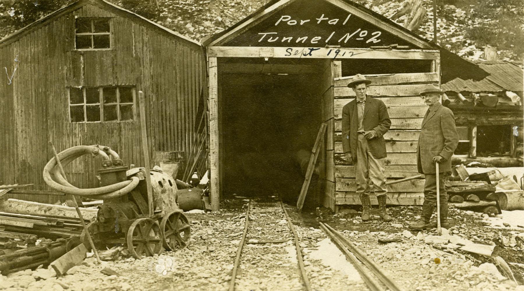
Wade McClung located a number of claims farther up Sulphur Creek near the base of Stinking Water Peak. In 1903 McClung sold his claims to the Winona Gold & Copper Mining Company, an enterprise of Colorado mining men who poured money into developing the mines. Supplies and equipment had to be transported over 60 miles of rough terrain from the railroad depot in Cody. The company hauled up an entire steam boiler to wire the operation with electric power.
Above the camp they excavated a pair of tunnels on the Greenhorn Claim following veins of copper ore. McClung had originally discovered the location in the 1890s but he lacked the funds to excavate it. Employees of the Winona Company later performed the work, living at the mines most of the year. Eventually, winter weather in the mountains made it impossible to live at the high altitude.
The Winona Company had a good operation on Sulphur Creek, but logistics and transportation were still the major obstacles. The company surveyed a narrow-gauge railroad line up the Clarks Fork Canyon and beyond to Sunlight Creek. With a prospectus written by Henry C. Beeler, a former geologist for the Wyoming Territory a mining engineer for the Winona Company, they tried to sell investors on the railroad. As Beeler put it, “In my opinion the showings of ore and formations justify a most active campaign of development with a suitable equipment as herein outlined and there is no doubt in my mind as to the ultimate success if this enterprise.”
Just as with Painter’s mines, hopes were high and talk was big. But the boosters found no funders. The railroad was never built. It was too big an investment for a chancy return. The Winona mines fizzled out as well. When President Woodrow Wilson fixed copper prices during World War I to sustain the war effort, the Winona camp was doomed. The company ceased mining operations in 1922.
Needle Creek on the South Fork
In 1888 the Livingston [Montana] Enterprise reported that a certain R.B. Dunham had “just returned from a month’s prospecting trip on the south fork of the Stinking Water in Wyoming.” The paper proclaimed that the “samples of Galena ore he brought certainly justifies him in the belief that he has discovered some valuable mining property that will some day make him rich.”
Dunham’s find came to nothing, but two years later the Livingston Enterprise reported an “extraordinary strike” southwest of present Cody on the South Fork of the Shoshone, as if Dunham had not already made the location. New sources claimed to have found “a ledge of galena ore sixty feet wide” and talked of “many men […] flocking in to locate claims on the ledge.” It became hot talk among mining men in the area, and soon the Red Lodge-Meeteetse, Wyoming stagecoach was making extra runs into the Big Horn Basin carrying prospectors lusting for quick claims.
Dunham’s claims shone even brighter when the Burlington Railroad began making noise about building a line up the South Fork to access Yellowstone National Park and beyond. With the possibility of easy railroad transportation, what had initially seemed a second-rate deposit became a potentially profitable endeavor.
A rush was on. “Ho! For Stinking Water. Let everyone get a shovel and pick and hie to the camp of promise” trumpeted the Billings Weekly Gazette in 1891. Noting the mule teams and miners daily setting off for the novel deposit, the newspaper observed: “The Stinking Water mining boom is upon us.”
The Elkhorn Mining District, as it became known, convinced many mineral men of its future as a bonanza. “Several well defined leads have been struck and the miners are driving tunnels and developing their properties with an energy which proves their faith in the value of their discoveries,” the Red Lodge Picket reported. “Many of them will remain in the camp prosecuting work during the winter, their intention being to develop the properties to such an extent as to make a showing which cannot fail to interest capitalists when the proper time comes.”

In September 1893, geologist Thomas A. Jaggar passed by Needle Creek on the South Fork of the Shoshone while traveling with Arnold Hague’s geological expedition exploring the mountains east of Yellowstone National Park. “Trail the most precipitous and dangerous we have seen over canon cut deep into lava,” Jaggar commented in his diary. “In one place trail [was] cut with pickaxe through solid rock along vertical wall.” This was most definitely the trail improvement work done by men looking to develop the mines. “Later trail descends into valley which widens out into a basin where four creeks come together,” Jaggar explained. “Here is the mine settlement, about three log cabins.” While examining the area Jaggar noted “prospecting tunnels” at the base of the nearby mountains.
Although Jaggar did not extensively document the particulars of the mining settlement, it is clear from his notes that miners were living there and presumably working the mines. The previous summer Hague had found recently deserted mining tunnels at the same site, suggesting mining activity had recently resumed.
The reason was probably the recent investment by a group of influential men. Buffalo Bill Cody himself, along with George Beck, Bronson Rumsey, Henry Gerrans, George Bleistein and other business partners, mostly wealthy easterners, were planning to irrigate a sizable portion of land from the Shoshone River and survey a nearby townsite that would become Cody.
After a few years of funding exploratory prospecting parties, Buffalo Bill and his investors formed the Shoshone Mining Company in 1896 and began working previously explored deposits in earnest. John Davies, a Wild West performer, homesteader on the South Fork and working partner in the mining enterprise was appointed overseer of the assessment.
Although the Shoshone Mining Company eventually conducted enough work on the mines to secure their patent, they failed to recover sufficient high-grade ore to profit. The remoteness and inaccessibility of the mines, more than six miles from the nearest road or homestead, did not help. Nor did the nonappearance of the railroad.
For 20 years the Shoshone Mining Company intermittently maintained its operation on the Needle Creek mines. Investor and local businessman George Beck recalled of the operation, “the minerals there were copper, pyrite, molybdenum, lead, antimony, a little showing of gold, and some silver.” Though it never produced a profit, the camp often doubled as a hunting lodge, “and we probably got enough fun out of it,” Beck later confessed, “to balance the ledger.”
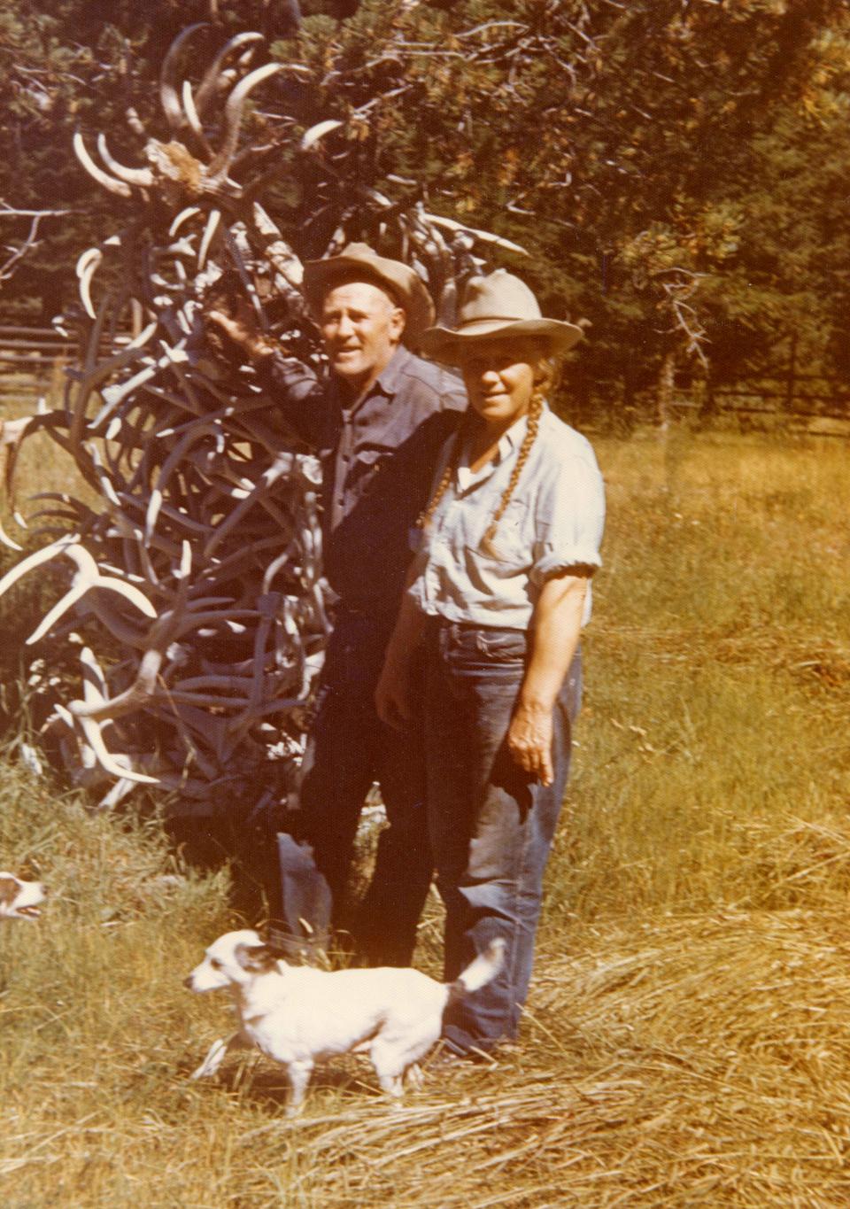
By 1916 the Shoshone Mining Company had concluded its work after years of no profits. For more than a decade the camp at Needle Creek sat silent until a pair of local miners, Jesse and Mickey Wight, assumed the old claims at Needle Creek and transformed the abandoned camp into a wilderness oasis.
Kirwin on the Wood River
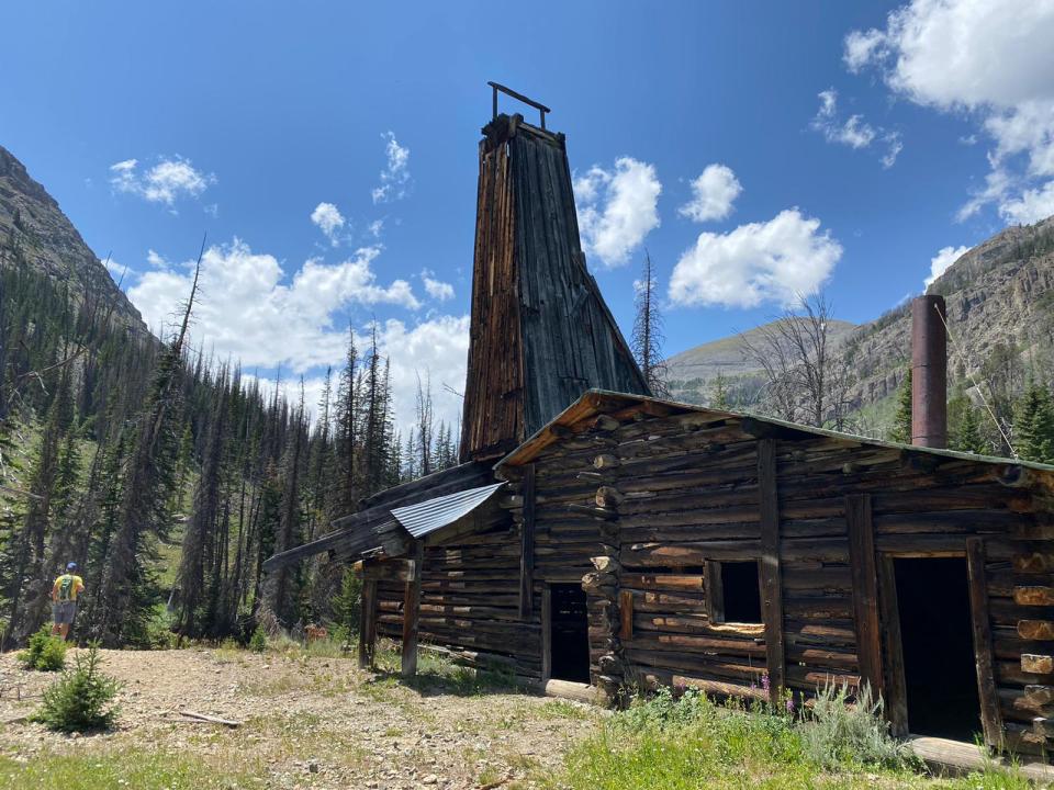
One mountain divide south from Needle Creek were mines on the Wood River at the town of Kirwin. These are arguably the most well-known of Park County’s onetime mining operations as they are the most accessible and contain the best-preserved features.
In 1885 Colorado prospectors Bill Kirwin and Henry Adams happened upon signs of minerals while deer hunting on the slopes of Spar Mountain. Excitement, initially confined to the Bighorn Basin, soon spread to towns and mining centers in nearby states.
In 1891 the Billings Weekly Gazette reported, “about fifty men are in camp now and prospecting progresses merrily…. The majority of rock is easily crushed and possibly free milling, bearing gold, copper, and silver in sufficient qualities to make it pay big.” Language like this spread quickly. “It is now a confirmed fact that the new camp has the mineral,” the Red Lodge Picket exclaimed in 1892, “and all that is needed is men with capital to make through developments. A railroad, of course, is the crying need of the camp, and undoubtedly it will come sooner or later.”
A wave of Colorado and Black Hills miners came up the Wood River hoping to locate claims. The traffic required a road from ranch land along the Greybull River to the high headwaters where most of the mineral activity was occurring. A town site sprouted in 1892.
At its peak, Kirwin boasted more than 200 people. Its 40 buildings included a hotel, a boarding house, a post office, a blacksmith shop, an assay office, a sawmill and a number of smelters to process the ore.
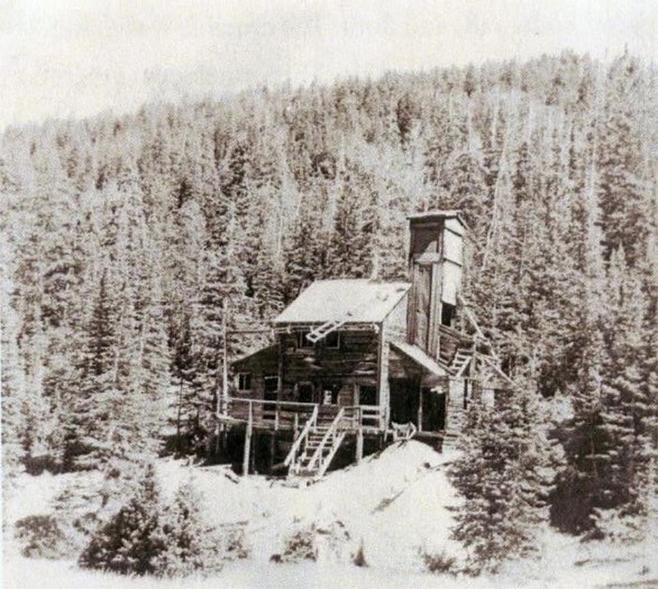
Once the Burlington Railroad reached Cody in 1901, miners at Kirwin could more easily and cheaply transport mining equipment to the Wood River, triggering further development. Of course, everyone involved hoped for a spur line to their camp. With the prospect of cheap railroad transport looming, mining companies felt justified “literally pouring their money into this mining camp,” Cody Enterprise reported in 1905, to lure the Burlington to build the spur.
But the railroad never came. Mining at Kirwin limped along until 1907, when an avalanche killed three residents and destroyed part of the town. All the remaining inhabitants gave up and left. The mines were not making money anyway, and as railroad hopes dwindled, rebuilding the town while risking more avalanches did not seem worth it.
Gold Reef Mines
Perhaps least known of the Absaroka mining regions is the Gold Reef Mining District.
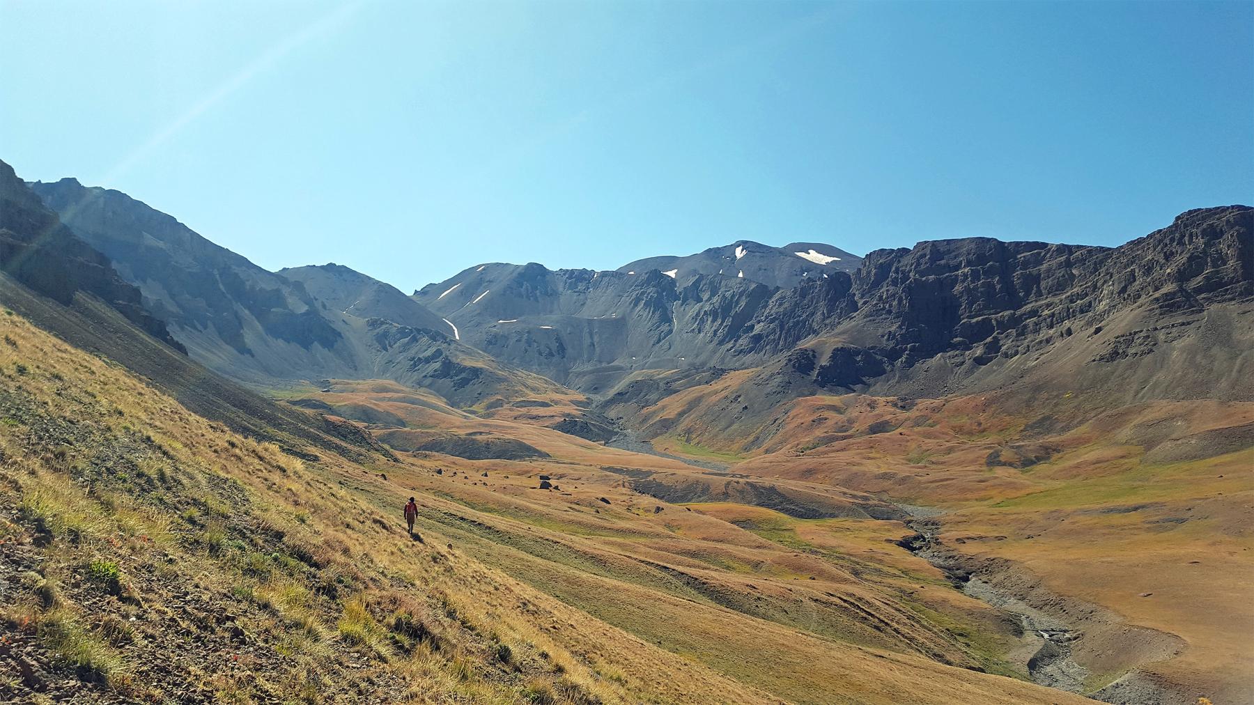
The targets were four gold veins emerging from rock on a northern spur of Franc’s Peak at the head of Jack Creek, a tributary of the Greybull River. If these ore deposits had existed in a more convenient location the Gold Reef might have amounted to more, but throughout its history the operation struggled to bring in the machinery and modern technology needed to make extraction profitable.
A group of investors from Chicago owned the mines for much of the time they operated. These businessmen were apparently unfamiliar with mining and had no interest in day-to-day activities at the mines. Only a few even bothered to visit the site.
Perceptive locals speculated that the Gold Reef was fraudulent, meant not so much to mine minerals as to mine shareholders’ pockets. Miners at the site seemingly knew the operation would never be profitable but continued to dangle the promise of enormous riches, to keep receiving their pay without having to do much actual work.
Though tough to prove, this theory makes a great deal of sense. As many mining pursuits were drying up across the West in the early 20th century, there was a clear and significant financial incentive to preserve any mining work that remained. The fact that production at the Gold Reef mines did not cease when unprofitability became apparent suggests some degree of deception and fraud. Work continued sporadically at the site until 1914, when the company finally ceased operations.
Though it was abandoned more than 100 years ago, this historic mining complex has numerous structural ruins and adits. Wind and harsh weather at this high elevation has broken up much of the evidence of human occupation, though a visitor will still find plenty of history to investigate.
Conclusion
In the long run, what Wyoming lacked in gold and silver it more than made up for in fossil fuels: coal, oil and natural gas. These mineral resources brought their own type of development to the Wyoming landscape, just not high in the mountains.
Whether all the busted mining camps in the Absarokas should be interpreted as tragic misfortunes and missed opportunities, or wonderful blessings will be left to the reader’s judgment. But I hope that in tracing the history of obscure mining camps in remote landscapes we can all gain a better appreciation for the fascinating intersections of human agency and environmental factors that have shaped our historic interactions with these special places.
[Editor's note: Special thanks to the Wyoming Cultural Trust Fund, whose support helped make possible publication of this article.]
Resources
Primary Sources
The newspaper articles cited here are in the Park County Archives, or listed in the Wyoming Digital Newspaper Collection or the Montana section of Newspapers.com.
- “Along the Belt.” Red Lodge Picket, Dec. 5, 1891.
- Beeler, Henry C. Report on the Property of the Winona Copper-Gold Mining and Milling Company. Unpublished manuscript in the possession of John O. Housel.
- “Better Than a Gold Mine.” Red Lodge Picket, Nov. 26, 1892.
- “The Clark’s Fork Mines.” New North-West (Deer Lodge, Montana), April 14, 1871.
- “Clark’s Fork Mining District.” Billings Herald, March 22, 1883.
- “The Elkhorn Camp.” Red Lodge Picket, Sept. 3, 1892.
- “A Great Copper Camp.” Red Lodge Picket, May 4, 1900.
- “A Great New Enterprise.” The Wyoming Stockgrower and Farmer, July 19, 1904.
- “James Gourley, of Bozeman, Tells of Search for Placer Gold on Upper Clarks Fork.” Cody Enterprise, Oct. 17, 1923.
- “Kirwin.” The Wyoming Stockgrower and Farmer, Sept. 29, 1903.
- “The Kirwin Mines.” Cody Enterprise, Feb. 9, 1905.
- Mercer, A.S. Big Horn County, Wyoming: The Gem of the Rockies. Hyattville, Wyoming: A.S. Mercer, 1906.
- “Mines in the North.” Fremont Clipper, June 5, 1891.
- “Promising Sunlight Mines.” The Wyoming Stockgrowers and Farmer, June 11, 1908.
- “A Real Bonanza.” Red Lodge Picket, Aug. 20, 1892.
- “Resume of Mines.” Red Lodge Picket, Feb. 27, 1892.
- “Rich Ore in Sunlight.” Red Lodge Picket, Aug. 30, 1901.
- “Romance of Kirwin Interesting Story.” Northern Wyoming Herald, Feb. 23, 1921.
- Stinking Water Prospector, June 24, 1891.
- “Sunlight Basin Will Boom.” The Wyoming Stockgrower and Farmer, Nov. 22, 1905.
- “Sunlight Copper Country Will BE a Second Butte.” Park County Enterprise, Jan. 25, 1911.
- “Sunlight Mining Country.” Red Lodge Picket, Feb. 27, 1897.
- “Sunlight is Rich.” Cody Enterprise, Dec. 7, 1905.
- “Sunlight Will Shine.” Billings Gazette, Dec. 26, 1899.
- “Visit to Gold Reef.” Burlington Post, Aug. 17, 1905.
- “The Wood River Mines.” Billings Weekly Gazette, Oct. 8, 1891.
- “Work on Sunlight Mines.” The Wyoming Stockgrower and Farmer, June 4, 1909.
- “Yellowstone Pioneers.” Livingston Enterprise, Dec. 25, 1889.
Secondary Sources
- Curtis, Kent A. Gambling on Ore: The Nature of Metal Mining in the United States, 1860-1910. Boulder: University Press of Colorado, 2013.
- Haines, Aubrey L. The Yellowstone Story: A History of Our First National Park, Vol. 1. Yellowstone National Park, Wyoming: Yellowstone Library and Museum Association, 1977.
- Huseas, Marion McMillan. Sweetwater Gold: Wyoming’s Gold Rush, 1867–1871. Cheyenne, Wyoming: Cheyenne Corral of Westerners International, 1991.
- Greever, William S. The Bonanza West: The Story of the Western Mining Rushes, 1848-1900. Norman: University of Oklahoma Press, 1963.
- Mueller, Andrew C. Abysmal Luck in the Absarokas: Gold Reef – A Late 19th , Early 20th Century Mining Locality in Northwestern Wyoming. Master’s Thesis: Colorado State University, 2007.
- Murray, Robert A. “Miner’s Delight, Investor’s Despair: The Ups and Downs of a Sub-Marginal Mining Camp in Wyoming.” Annals of Wyoming 44, no.1 (Spring 1972): 25-56.
- Paul, Rodman Wilson. Mining Frontiers of the Far West, 1848-1880. New York: Holt, Rinehart, and Winston, 1963.
- Peterson, Richard H. The Bonanza Kings: The Social Origins and Business Behavior of Western Mining Entrepreneurs, 1870-1900. Lincoln: University of Nebraska Press, 1977.
- Smith, Duane A. Rocky Mountain Mining Camps: The Urban Frontier. Bloomington: Indiana University Press, 1967.
- Topping, E.S. The Chronicles of the Yellowstone. Minneapolis, Minnesota: Ross & Haines, Inc., 1968.
- Wasden, David J. From Beaver to Oil. Cheyenne. Wyoming: Pioneer Printing & Stationary Co., 1973.
- Weinstein, Allen. “Was There a ‘Crime of 1873’?: The Case of the Demonetized Dollar.” The Journal of American History, 54, no. 2 (September 1967): 307-326.
- Wells, Wyatt. “Rhetoric of the Standards: The Debate over Gold and Silver in the 1890s.” Journal of the Gilded Age and Progressive Era, 14, no.1 (January 2015): 49-68.
- White, Richard. “It’s Your Misfortune and None of My Own”: A New History of the American West. Norman: University of Oklahoma Press, 1991.
- Woods, Lawrence M. Wyoming’s Big Horn Basin to 1901: A Late Frontier. Spokane, Washington: Arthur H. Clarke Co., 1997.
- Worster, Donald. Under Western Skies: Nature and History in the American West. New York: Oxford University Press, 1992.
- Young Jr., Otis E. Western Mining. Norman: University of Oklahoma Press, 1970.
Illustrations
- The map is from a portion of the Wyoming map in Rand, McNally & Co.'s Indexed Atlas of the World (Chicago, IL: Rand, McNally, & Co., 1897) via the David Rumsey Map Collection.
- The photos of Cooke City, John Painter and Jess and Mickey Wright are all from the Park County Archives. Used with permission and thanks. The photo of the Wrights is by Oakleigh Thorne II, and was given by him to the archive.
- The photo of the Winona Company's tunnel mouth is from the Winona Company Prosepctus, John Housel collection. Used with thanks to him and the author.
- The photos of Hughes Basin, the Tumlum Mine at Kirwin and the Gold Reef Region are by the author, Brian Beauvais. Used with permission and thanks.
- The clipping from the November 22, 1905 Wyoming Stockgrower & Farmer is from the Wyoming Digital Newspaper Collection. Used with thanks.
- The photo of W.F. Cody and Dr. David Powell in the cabin at Needle Creek is courtesy of the Buffalo Bill Center of the West in Cody, Wyoming. Used with permission and thanks.
- The 1960s photo of the Wolf Mine at Kirwin is courtesy of the Meeteetse Museums. Used with permission and thanks.