Exposed: Pre-territorial Photography in Wyoming, 1842-1867
The earliest photographs taken in pre-territorial Wyoming are not as well-known as they could be. Some of the first photographers failed in their efforts to take images, due to technical inexperience, challenging environmental conditions, and inadequate supplies. Some of their successes are now lost, many are scattered in obscure public and private collections, and much of their work we only know about through published and manuscript accounts. A journey through some of this history is informative, and the surviving photographs are of great importance to the history of Wyoming, the American West, and photography itself.
Exploring the West, Paving the Way: John Charles Fremont
It is likely that in 1842 Lt. John Charles Fremont of the U. S. Corps of Topographical Engineers became the first individual to attempt taking photographs in the land we think of as Wyoming. Given the distance from eastern cities, it seems astonishing that this occurred less than three years after French painter Louis Daguerre shared with the world how to make pictures on polished sheets of silver-plated copper.
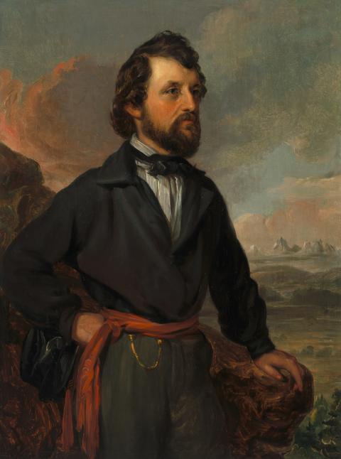
The daguerreotype was born to accurately depict images of people, buildings, landscapes and livestock. Infatuated, many customers in the United States patronized daguerreotype studios spreading to Philadelphia, New York and elsewhere across the land. Seeing the potential, Fremont ordered daguerreotype equipment and 25 plates in May of 1842 as he prepared for an expedition across the West from the Missouri River to the Rocky Mountains.
With orders to survey the Platte River west, Fremont began the expedition that would be the first of five he conducted over the next decade. His party included frontiersman Kit Carson as guide, twenty-one voyageurs, a cartographer, photography and surveying equipment, and a rubber boat.
The 1842 foray into the Rocky Mountains was the first expedition to include the capability of creating a photographic record that might be adapted into lithographs for illustrating a published report.
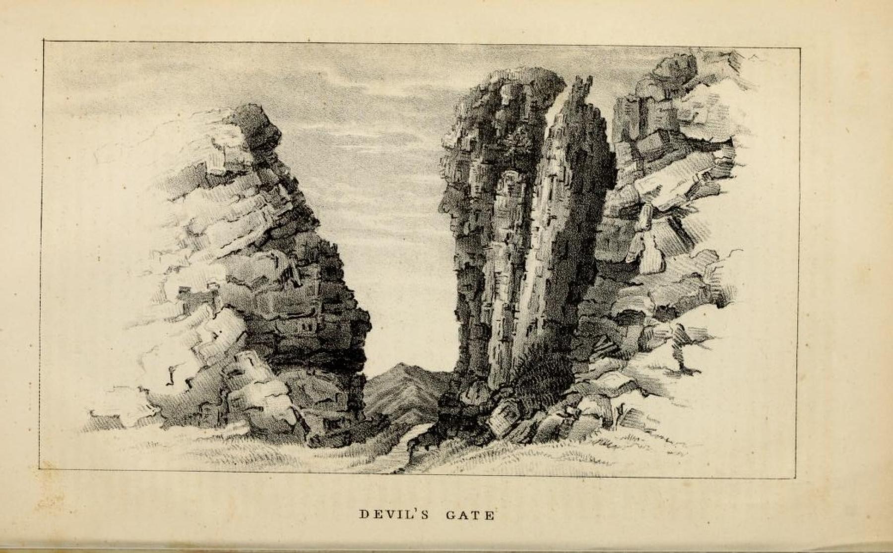
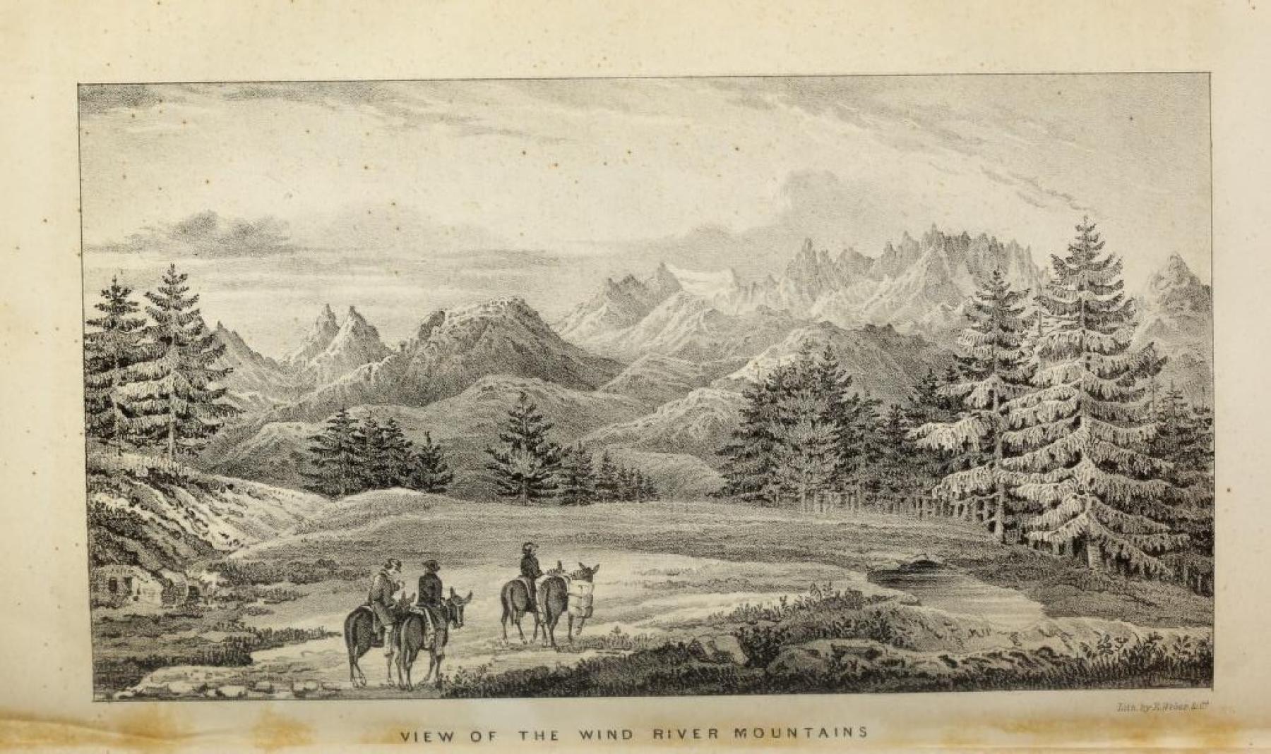
Although fascinated by the idea of taking daguerreotypes, Fremont was not skilled in the process. Under the best of circumstances, the polishing of silver-coated copper plates, the mixing of chemicals, and the adjustment of the camera was a difficult process, further complicated by wind, challenging temperatures, precipitation, and rugged terrain. Charles Preuss, the cartographer for the exhibition, became exasperated with Fremont near Independence Rock in August of 1842, writing that “Yesterday afternoon and this morning Fremont set up his daguerreotype to photograph the rocks; he spoiled five plates that way.” Three days later he noted that Fremont “said the air up here is too thin; that is the reason his daguerreotype was a failure. Old boy, you don’t understand the thing, that is it.” He later lamented Fremont’s failure to record an image of the Wind River Mountains, writing that “This time it was really too bad, because the view was magnificent.”
Even if any Fremont daguerreotypes were completed, none have survived. Fremont’s second excursion to the West in 1843 also included photographic equipment, but he left no record of its use. Then, in 1853, on his final foray into the West, he enlisted the services of painter and photographer Solomon Nuñes Carvalho. The process of photography had improved, but out of several hundred daguerreotypes taken by Carvalho during this expedition, only one is thought to have survived. None related to Wyoming.
Photographers and the Oregon Trail
Government-sponsored expeditions served to document the land and its resources, reinforcing the idea that the United States was destined to occupy the continent to the Pacific Ocean. In response, civilians from across the country and around the world flooded west in search of free land, gold, and opportunities untold.
Fremont’s report of the 1843 expedition was published in 1845, a year when westward emigration totaled fewer than 6,000 people. The publication did serve as a mainstay of information for travelers and, along with a growing number of trail manuals and maps, provided information on the routes and supplies to take, how to prepare, and where to find water and grass. By 1851 the number of travelers exceeded 100,000 as interest in the West became increasingly amplified.
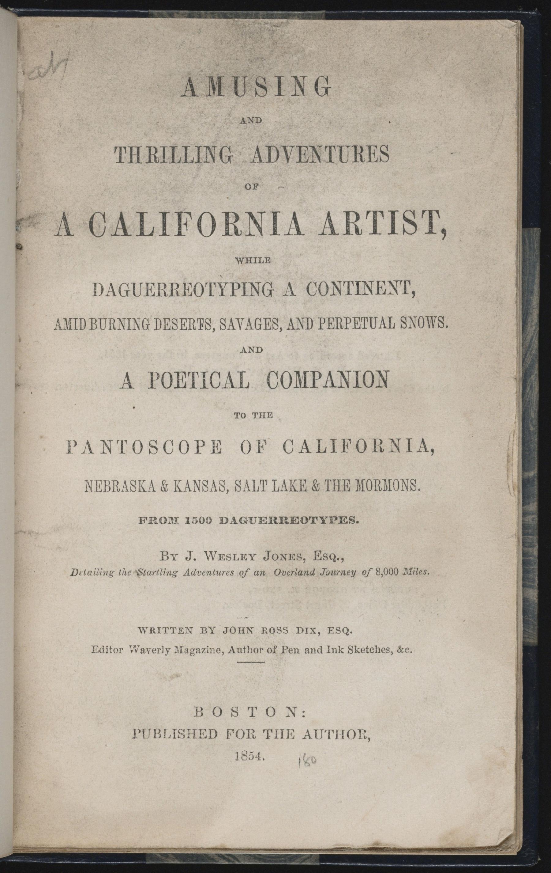
Interestingly, a project to photographically document the trails west began in California, and headed east. It clearly had commercial motivations and anticipated great interest from Eastern audiences. Ambitious entrepreneur John Wesley Jones executed what has been described as the most extensive photographic project of the time. He later reported that some 1,500 daguerreotypes were created in California and along the Oregon Trail to St. Louis. These, and sketches drawn by artists in his entourage, became visual notes for skilled painters to create a grand narrative canvas, a panorama he called the “Great Pantoscope of California, The Rocky Mountains, Salt Lake City, Nebraska & Kansas.” The painting stretched ten feet high and hundreds of yards long. It rolled between two spools in front of audiences in Boston, the Massachusetts port city of New Bedford, New York City, and other locations, accompanied by lecture notes presented for dramatic effect by Jones.
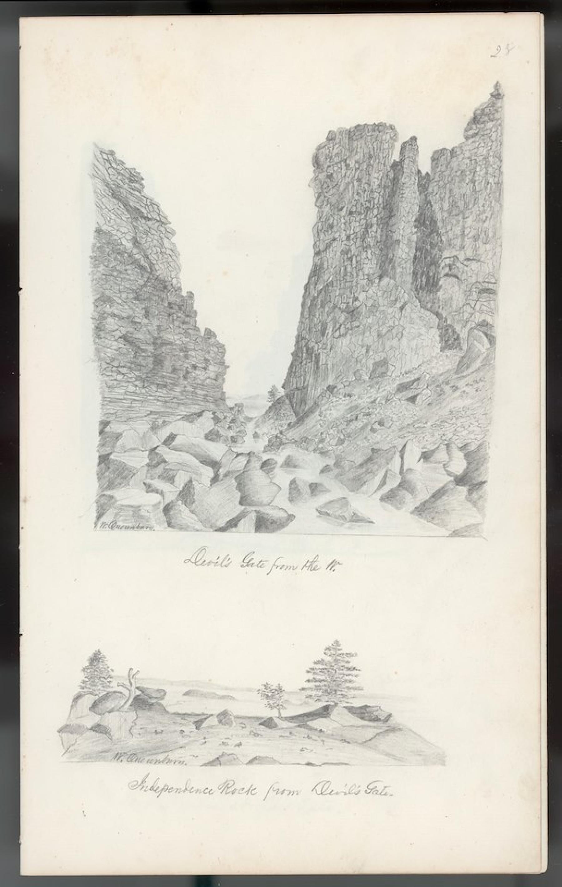
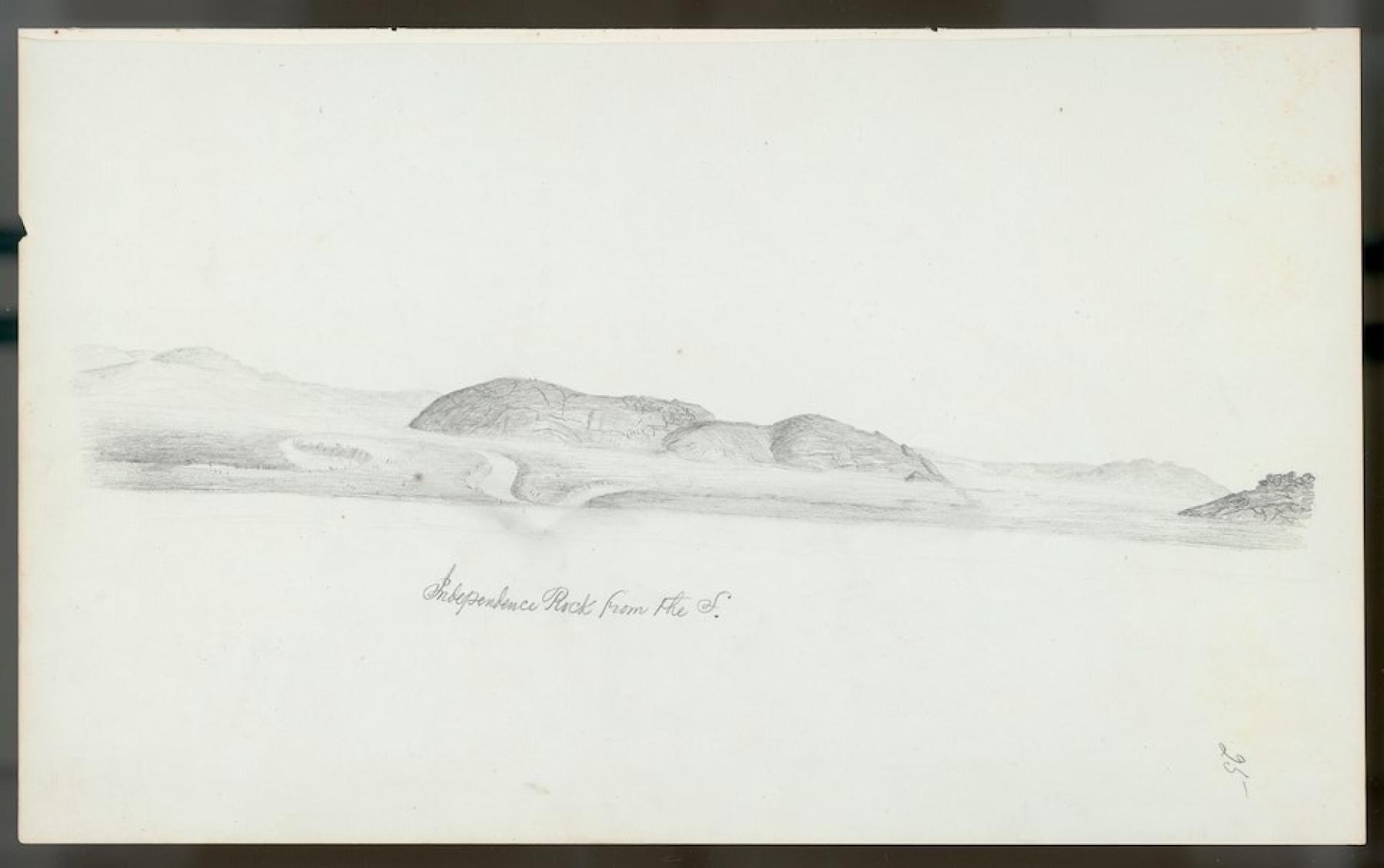
As the basis for the pantoscope, between July and October of 1851, drawings and daguerreotypes captured familiar locations such as Devil’s Gate, Independence Rock, Laramie Peak, and Fort Laramie. While Jones stressed the importance of the 1,500 daguerreotypes (most of which were shot in California) to the creation of the final painting, they seem to have retained little value in and of themselves. They simply may have been cast aside; there is no evidence that they survive today. It is tantalizing to imagine what value they would have. Fortunately, two sketchbooks created along the trail by artist William Quesenbury survive, giving us a sense of what the lost daguerreotypes might have documented.
Photography in the 1850s
Other photographers produced notable photographs along the Oregon Trail in the late 1850s. The technology of photography had improved and in the early part of the decade wet-plate collodion glass negatives and paper prints made the creation of duplicate and larger prints possible. Images could also be produced more quickly with shorter exposure times. The process was still complicated and it remained necessary to pack and move heavy and delicate glass plates along with equipment and chemicals. There also needed to be a wagon or other space to create a dark room for processing light sensitive prints.
Government Photographers: The Simpson Expedition and Photographers Samuel C. Mills and Edward Jagiello, 1858

Sometime in the winter of 1857-1858, David Auguste Burr traveled east from Salt Lake City to the region around Fort Bridger. He worked as a map maker, topographer, and notably as Surveyor General of Utah. As a photographer he created a small number of images of the region, including one depicting armed infantry and a wagon loaded with firewood at Fort Bridger or nearby Camp Supply. Many other photographers would follow.
Other photographers would be traveling west. As some 2,000 troops mobilized to march west to Utah in 1857, the goal was to assert federal authority against the Mormons. Captain James H. Simpson of the Corps of Topographical Engineers accepted the responsibility for surveying their route along the emigrant road from Nebraska to Fort Bridger. In preparation, he gathered supplies, scientific instruments, and support personnel. He acquired the latest in camera equipment and hired Washington, D. C., photographer Samuel C. Mills, with Edward Jagiello as his assistant, to make the most of capturing images along the route. After arriving at Fort Leavenworth, they practiced with the camera, creating a number of shots of buildings at the post and of Simpson’s camp. The captain took an active part in directing their efforts with the goal of capturing “as many prominent scenes as possible . . . including . . . Court House & Chimney Rocks, Fort Laramie & every other proper object or scene.”
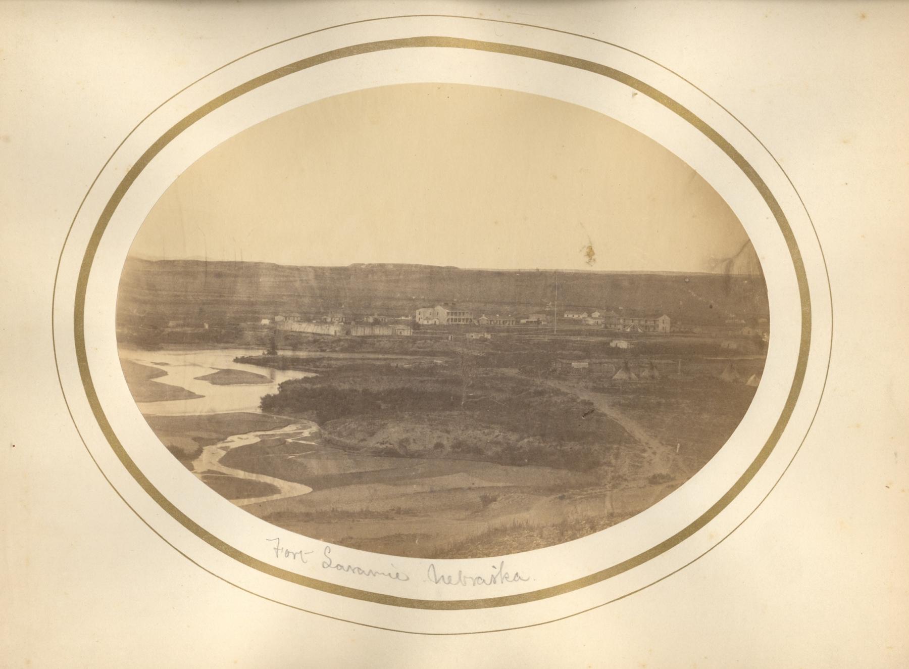
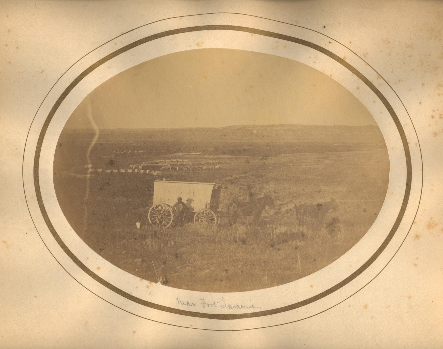
Following these directives, Mills and Jagiello produced the earliest known images along the emigrant road, including shots of Forts Laramie and Bridger, and Devil’s Gate. These and other images shot in Nebraska and Utah were made into paper prints, the security for which was tightly controlled by Captain Simpson. He saw them as potential tools for public relations but still had doubts about the camera as a tool. The process was laborious; weather made their work difficult, and he wrote that “the camera is not adapted to distant scenery.” Subsequently left unpublished the Mills and Jagiello photographs were rediscovered in recent years, hidden in expedition and other records at the Library of Congress and the National Archives.
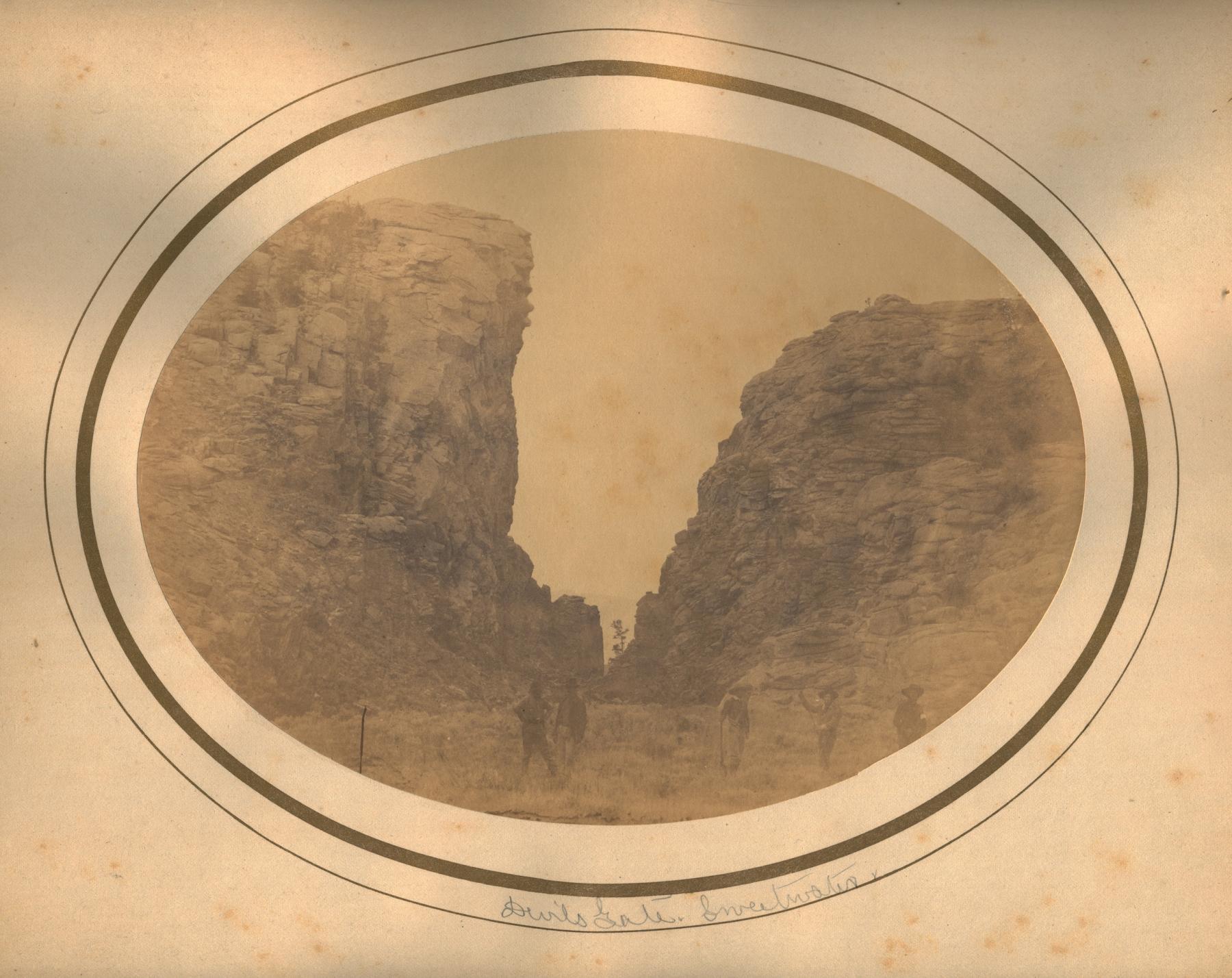
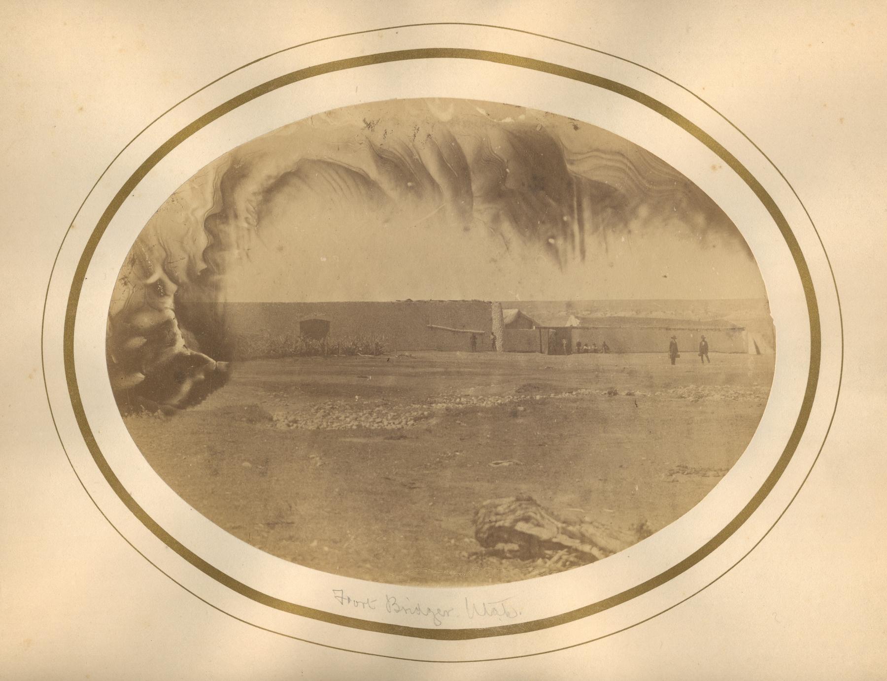
The Raynolds Expedition, 1860: Photographer James Hutton
As the Simpson expedition in Utah was running short on supplies in the spring of 1859, Captain William F. Raynolds, also of the Corps of Topographical Engineers, prepared for an expedition charged with exploring the region “through which flow the principal tributaries of the Yellowstone river, and the mountains in which they . . . and the forks of the Missouri have their source.” In addition, they were to gather information on native tribes and the natural resources of the land, the climate, the navigability of streams, and the potential for “rail or common roads.”
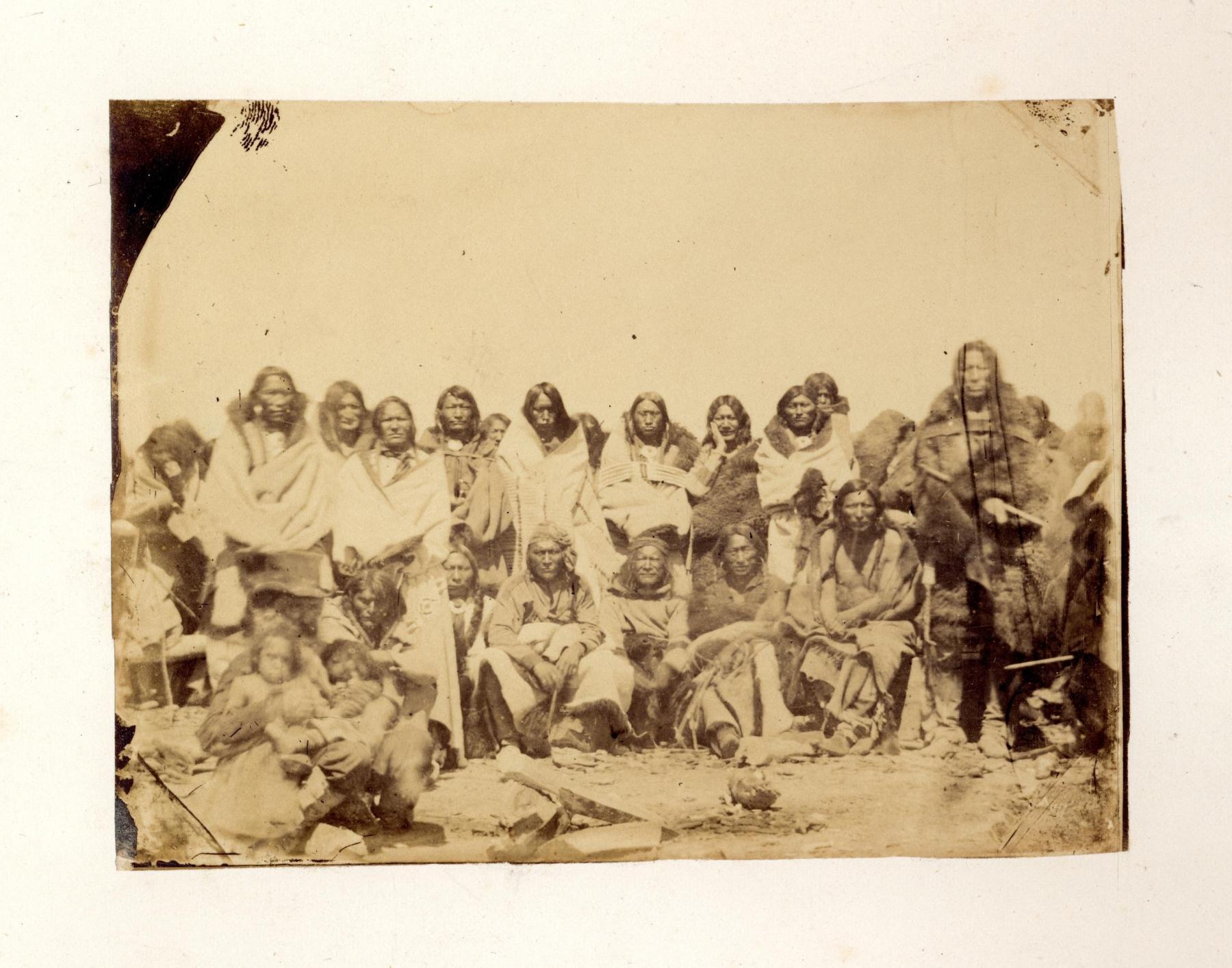
Raynolds rapidly prepared for the excursion, hiring topographers, an artist, a surgeon, and a geologist. James D. Hutton was engaged to serve as topographer and assistant artist. Notably, he created wonderful drawings of the landscapes and, with responsibility for photographic equipment, shot photographs as well. Raynolds regularly criticized Hutton’s character and the “indifferent” quality of his photographs. The expedition traveled over 2,500 miles and charted significant parts of what became Wyoming. Despite Raynolds assessment of Hutton, the photographer produced a number of important photographs when the expedition spent the winter at Deer Creek.
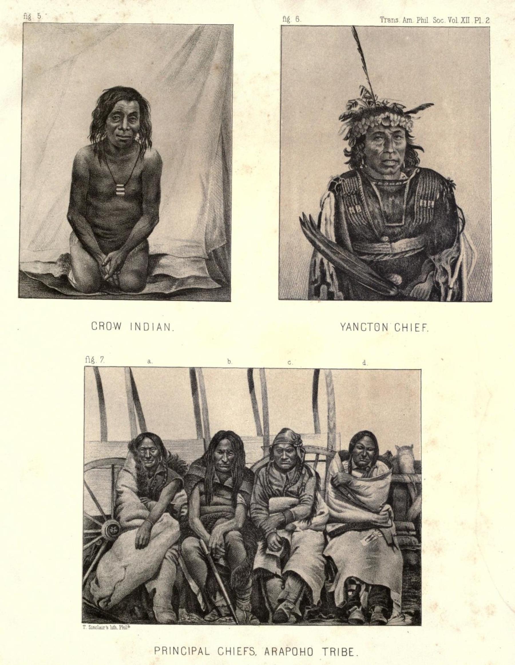
It appears that there were intentions to translate the photographs into lithographs to illustrate an expedition report, but the publication was interrupted by the Civil War and did not appear until 1868. The only illustrations in the report were based upon drawings done in the field. What happened to the photographs? As it turns out, seven of Hutton’s photographic portraits of Arapaho people taken at Deer Creek were adapted as lithographs and published in geologist Dr. F. V. Hayden’s Ethnography and Philology of the Indian Tribes of the Missouri Valley (1862). As such, these images are identified as the first published photographic portraits of Native Americans taken in the field. Today, original prints of the images shot at Deer Creek reside in the collections of Yale University’s Beinecke Rare Book and Manuscript Library and at the British Museum in London. They stand among the few 1850s photographs taken on the emigrant road in the what is now central Wyoming.
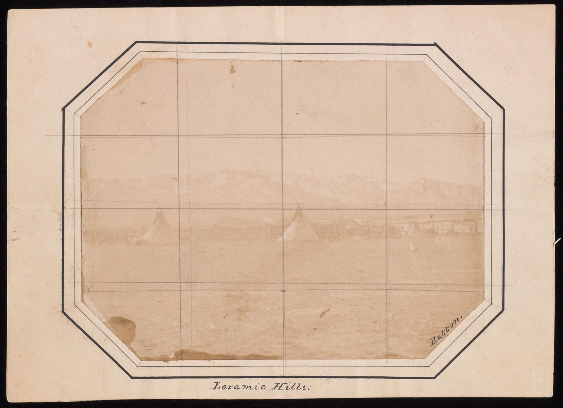
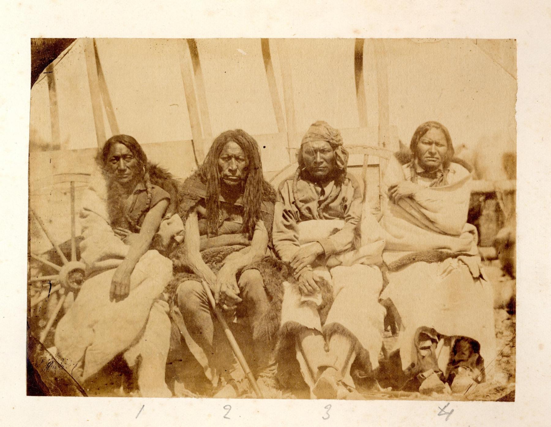
Civilian Photographers: The Lander Expedition and artist Albert Bierstadt, 1859
In late April of 1859, engineer Frederick W. Lander led an expedition to survey and create an improved road that could support freight and emigrant wagons from the South Pass west. This entourage, which led to development of the Lander Cutoff, included a young painter named Albert Bierstadt. His goal was to study scenery and Native American life to inform a series of paintings. After the trip, Bierstadt became one of the most prominent artists of grand landscapes of the American West. Fortunately, he was also a practiced photographer and shot many images along the trail.
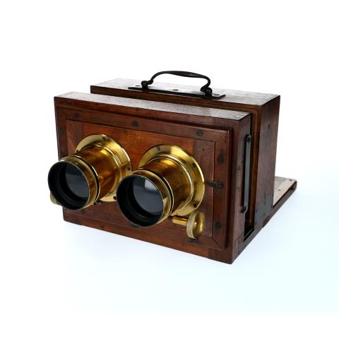
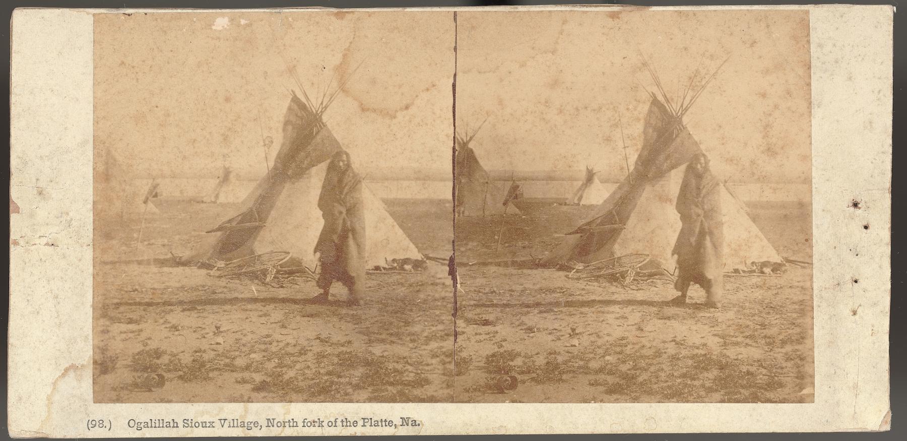
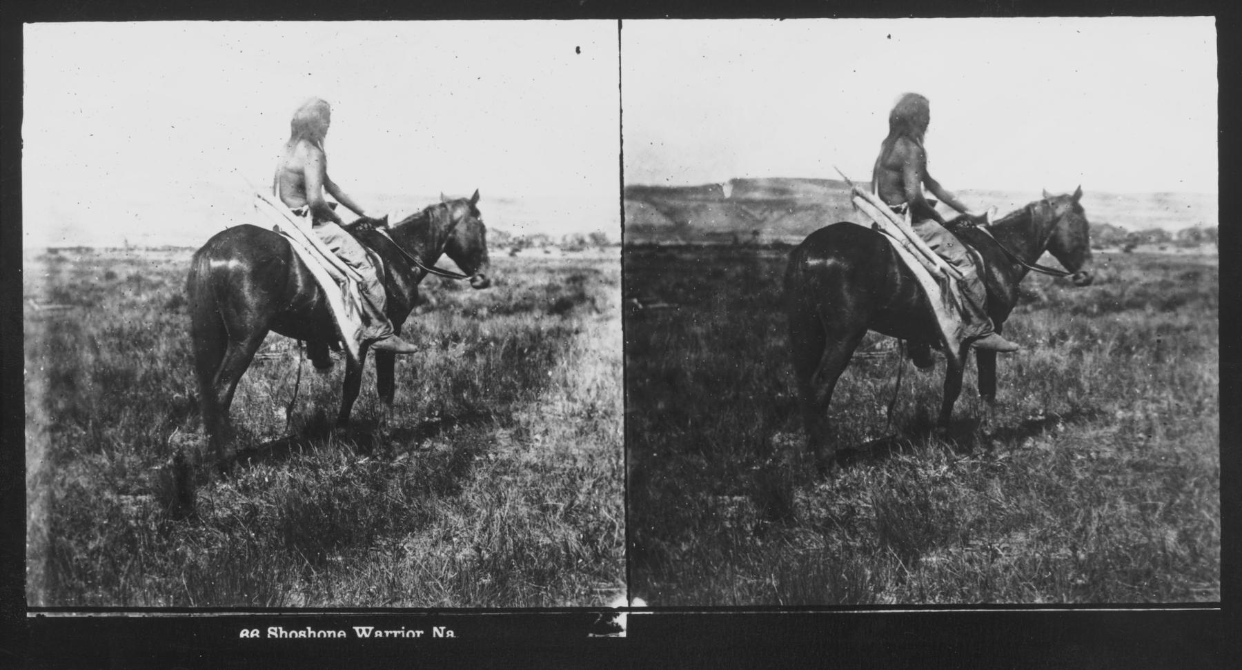
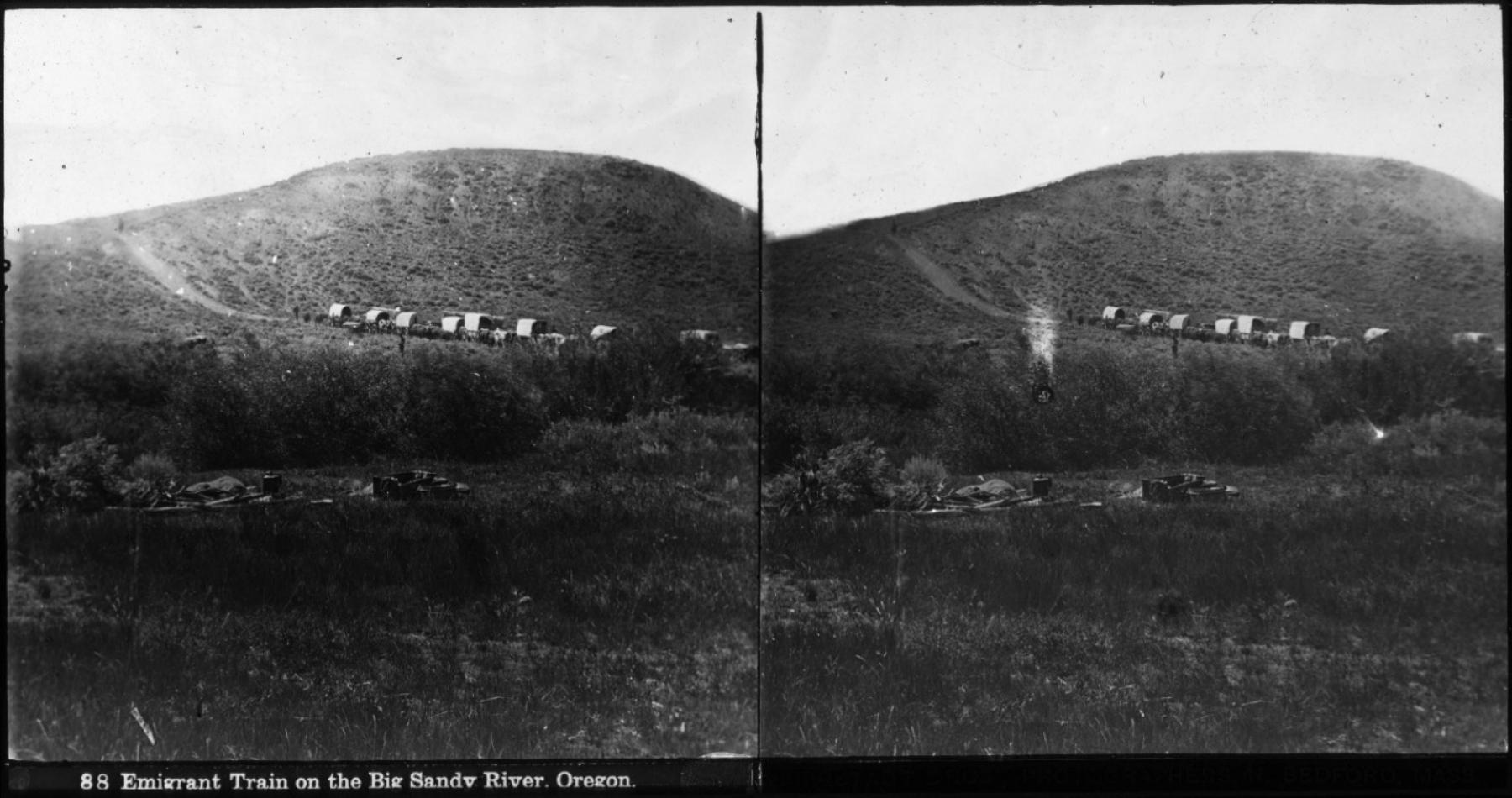
Bierstadt traveled at his own expense, carrying painting supplies and a stereo camera with related accessories, glass plates, and chemicals. The stereo camera had two lenses roughly 2.5 inches apart to mimic the distance of human eyes, which captured two views of a scene at slightly different angles simultaneously. Once printed the images could then be viewed using a stereoscope to create a 3-dimensional image for the viewer. Stereo cameras and stereoscopes were relatively new inventions that were widely embraced by the public in the 1850s. Lander soon recognized the camera’s value, describing Bierstadt’s resulting “stereoscopic views of emigrant trains, Indians, camp scenes, etc., which are highly valuable and would be interesting to the country.” Bierstadt also reported his efforts to Eastern publications, writing that “We have taken many stereoscopic views, but not so many of mountain scenery as I could wish . . .. We have a great many Indian subjects. We were quite fortunate in getting them, the natives not being very willing to have the brass tube of the camera pointed at them.”
They traveled at nearly the same time as the Raynolds expedition, though the two photographers’ paths never crossed. During his journey Bierstadt pointed the camera in many directions, capturing scenes of Indigenous life in Nebraska, of the expedition itself, of the area around Fort Laramie, and of emigrants on the trail. As a civilian artist, Bierstadt owned his images and did not make them available for government use. They became, along with sketches, visual sources for incorporation into paintings. Among them are the first known images of emigrant wagon trains and other scenes along the trail. His unique images were turned over to two of his brothers and copies were sold commercially. Buyers found entertainment value in viewing the stereo images through home viewers and as a result, more have survived and are scattered today at a number of historical societies and archives.
Photographers traveling on the Oregon and Overland Trails
Some overland emigrants happened to be photographers, but they were all in a hurry, headed somewhere else with little time to stop and follow the laborious process of taking pictures. Dennis Townsend, daguerreotype hobbyist, was one of those who traveled over the Oregon Trail in 1852 yet took no pictures. Later, he shot daguerreotypes in California. Likewise, Wilbur F. Bailey crossed with his equipment in 1860, but took no known pictures. Arriving on the West Coast, he operated a studio in California.
A few travelers did linger. Among them, an unnamed photographer stopped for over two weeks at Fort Halleck in 1864 where he took portraits for paying customers such as Acting Assistant Surgeon Dr. J. W. Finfrock, before heading for Salt Lake City. At the same time, Acting Assistant Surgeon John Lance Lauderdale was stationed at Fort Bridger starting in the spring of 1864, where he provided medical services to California and Michigan troops, became a friend of entrepreneur W. A. Carter, was active in a temperance group, hunted, and pursued a strong interest in photography leading to his presentation of entertaining lantern slide lectures. He returned east in the summer of 1866. His papers and some images are preserved at Yale University
Finally, one of the best-known Western photographers, Charles Savage, followed the Oregon Trail to Salt Lake City in 1866. While he shot a number of important stereo views in Nebraska, it appears that he did not take any more until settling in Utah. His famous photographs of the driving of the golden spike at Promontory Point in 1869 are among the best known of his work there.
First Resident Photographer: Sarah Larimer
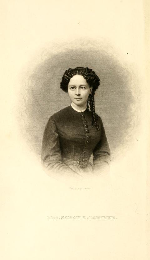
One of the emigrant photographers following the Oregon Trail in 1864 planned on setting up a photo studio in Idaho or Montana to cater to miners and merchants wanting a portrait. It was rare for a woman to work as a professional photographer, but Sarah Larimer and her husband William, with their eight-year-old son Frank, headed west. Their wagon contained personal belongs and the equipment and supplies for photography and goods for William’s merchant business. Frontiersman John Sublette recalled years later that Larimer took photographs along the trail, including one of Chimney Rock in Nebraska, but this is not confirmed and images have not been found. The Larimers were part of a small wagon train that was approached by a group of Oglala Sioux. On July 12, the wagons encamped at Little Box Elder crossing (roughly ten miles west from present day Douglas, Wyoming). There, the Sioux attacked the surprised emigrants. Four men were initially killed and the camp destroyed.
Sarah Larimer, her son Frank, Fanny Kelly, and Fanny’s young niece Mary were taken captive. Sarah and Frank escaped several days later. Mary was killed and Fanny was not rescued for another five months. William Larimer, although wounded, found his way to Deer Creek Station where 11th Ohio surgeon Dr. Alfred Zeigler saw to his care. After Sarah and her son rejoined him, they were thankful to have survived, but suffered with uncertainty for the future with the total loss and destruction of their property. An Ohio officer described their losses from the attack as consisting “of a fine collection of pictures, photograph apparatuses, and stock for that kind of business.” With the support of the 11th Ohio’s Lt. Col. William O. Collins, they moved to Fort Laramie where he helped them to find housing.
The Larimers decided to settle and establish Sarah’s photography studio and with borrowed money ordered replacement camera equipment and supplies from Leavenworth, Kansas. It took two months for the material to arrive at Fort Laramie. The venture only lasted until April of 1865, yet Sarah Larimer was the first professional photographer to live and work in what two years later would become Wyoming Territory. The young family left and headed to Colorado. William pursued business interests and Sarah continued photography. With arrival of the transcontinental railroad in 1867, they again moved to Wyoming where for a short time they settled in the railroad town of Sherman where Sarah had a studio and William sought business opportunities.
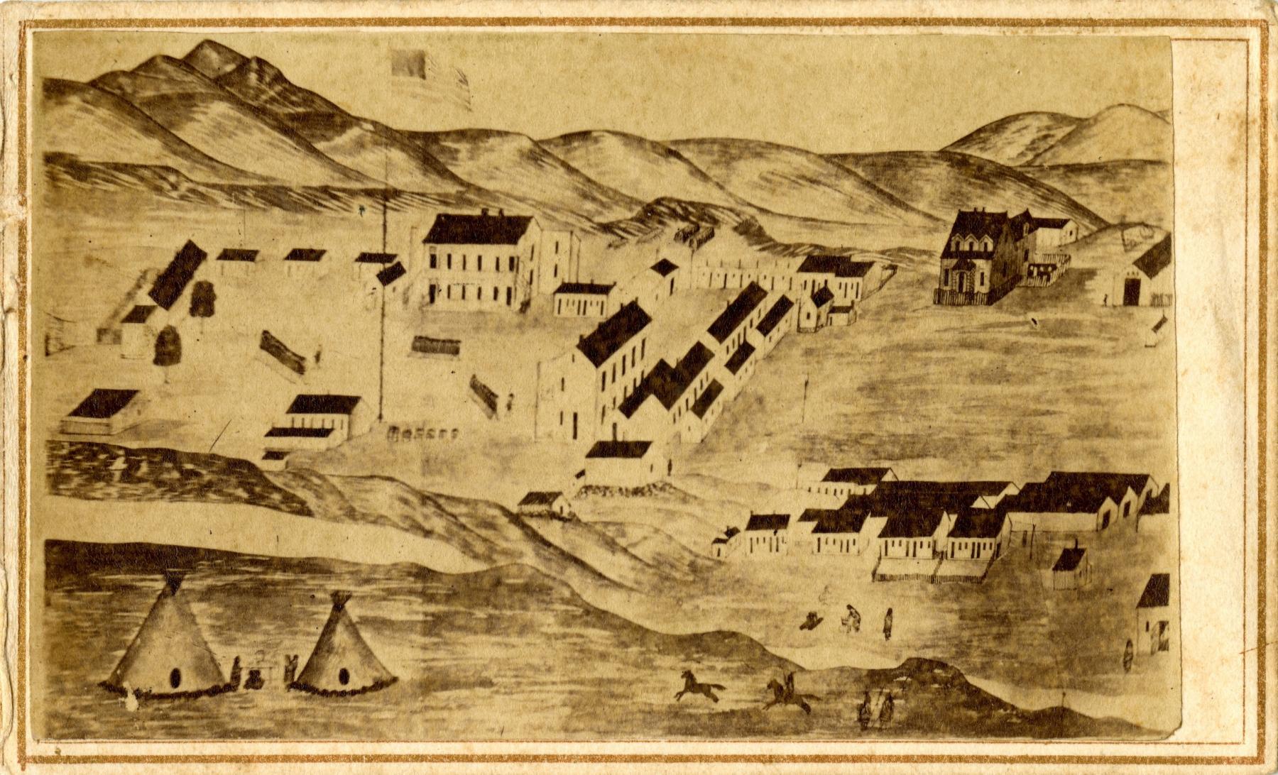
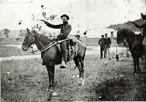
The mounts for photographs taken by Sarah Larimer at Fort Laramie do not include her name or the location. Only the subject matter and provenance of some images suggest that she took them. Likely images are found in the form of cartes de visite and as tintypes. She may have shot ambrotypes, which are images on glass backed by black fabric or paint. Some likely to be hers are related to the 11th Ohio Volunteer Cavalry, a unit fondly regarded by the Larimers for supporting Sarah and her husband at both Deer Creek Station and Fort Laramie following the July 1864 attack.
Photographers and Indian Treaty Negotiations: 1866-1868
Ridgway Glover, the 1866 Fort Laramie Treaty, and Fort Phil Kearny
Ridgway Glover first gained recognition for photographs he took of President Abraham Lincoln’s funeral. Based in Philadelphia, he had ambitions to head west. In late 1865 Glover began corresponding with Spencer Baird, Assistant Secretary of the Smithsonian Institution, writing that he wished “to have an opportunity of traveling through that country.” Could Baird help him join an expedition? It was not until the spring of 1866 that Glover accepted an opportunity to become the first photographer to document Indian treaty negotiations, in this case at Fort Laramie. He arrived in Nebraska in mid-May and by early June the treaty commissioners and tribes gathered at the fort. It was a tense setting as the Sioux insisted on keeping traffic out of the Powder River country.
Writing to the Philadelphia Photographer on June 30, Glover reported that “I have been in this wild region nearly a month, taking scenes in connection with the Treaty that has just been made with the Sioux, Arapahoes and Cheyennes, and have secured twenty-two good negatives.” He confessed difficulty in getting good clean images and in maintaining a stock of supplies. There was also reluctance and even fear from some of the native subjects who did not want to be photographed.
Once the treaty negotiations were over, Glover headed north to Fort Phil Kearny on July 18 with a wagon train that included army officers, a chaplain, ten privates, nine drivers, three women, and five children. During the trip, the party encountered Cheyennes and Glover attempted to take pictures. As a photojournalist, he allied with Frank Leslie’s Illustrated Newspaper and he continued to send letters for publication in the Philadelphia Photographer. In one letter he reported living with wood choppers in the mountains and noted that he awaited the delivery of chemical supplies and had broken the ground glass of his camera.
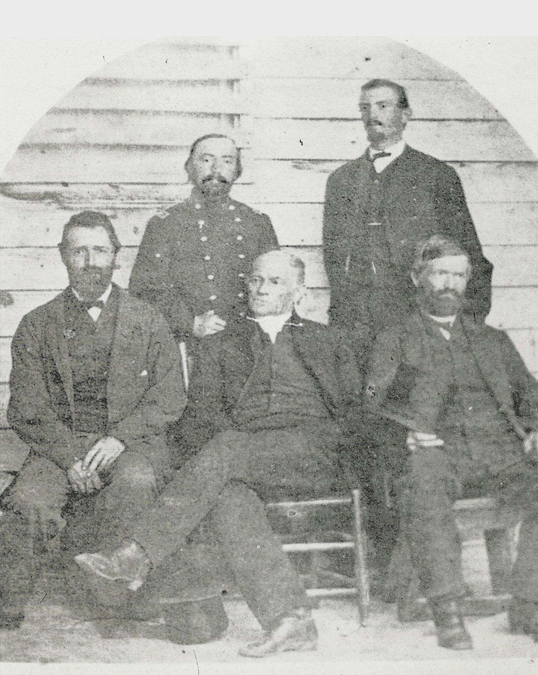
Ignoring warnings about the immediate threat of Indian attack, Glover wandered alone. In September his scalped and mutilated body was found and obituaries appeared several months later in Leslie’s and the Philadelphia Photographer. The promises Glover made to supply photographs to the newspapers and to the government could not be kept. Historian Paula Fleming concludes that he created no photographs at Fort Phil Kearny and treaty images, thought to have been sent back east, appear to be lost. One probable survivor is known, a group portrait of the treaty commissioners.
Alexander Gardner and the Fort Laramie Treaty, 1868
The second and most successful opportunity for photography to take place during Indian treaty negotiations occurred at Fort Laramie in May of 1868, just two months prior to Wyoming becoming a territory. Alexander Gardner was the photographer’s name, and this Scottish-born figure had gained prominence for creating a major body of work recording people and scenes during the Civil War.
Negotiations at Fort Laramie combined civilian and military commissioners to conduct deliberations, and there were hopes for concluding hostilities that had led to the destruction of William Fetterman’s command near Fort Phil Kearny in 1866. The treaty resulted in abandonment of Forts C. F. Smith, Phil Kearny, and Reno along the wagon route to Montana. Before the treaty negotiations, Alexander Gardner had already photographed the path for a railroad route crossing Kansas and heading to further points west. Stereograph images were published afterward, and a visual document of large format pictures was published as Across the Continent around 1869.
This project served as a pattern for Gardner in imaging the 1868 Fort Laramie treaty. Gardner produced a large number of stereo images and larger glass plate images portraying the grounds of Fort Laramie, Native American encampments, frontiersmen, actual treaty negotiations, and the distribution of annuity goods to the tribes. These formed a visual census of diverse peoples at the scene. As a pictorial document, they tell us of the Crow, Sioux, Cheyenne, and Arapahoe present at the time. In their company are soldiers, commissioners, commission staff, interpreters, mixed-race families, traders, clerks, and laborers. They record an event of lasting importance. Gardner’s work was well known at the time, and a number of significant collections of these images are located at institutions from Missouri to London.
Coming of the Railroad
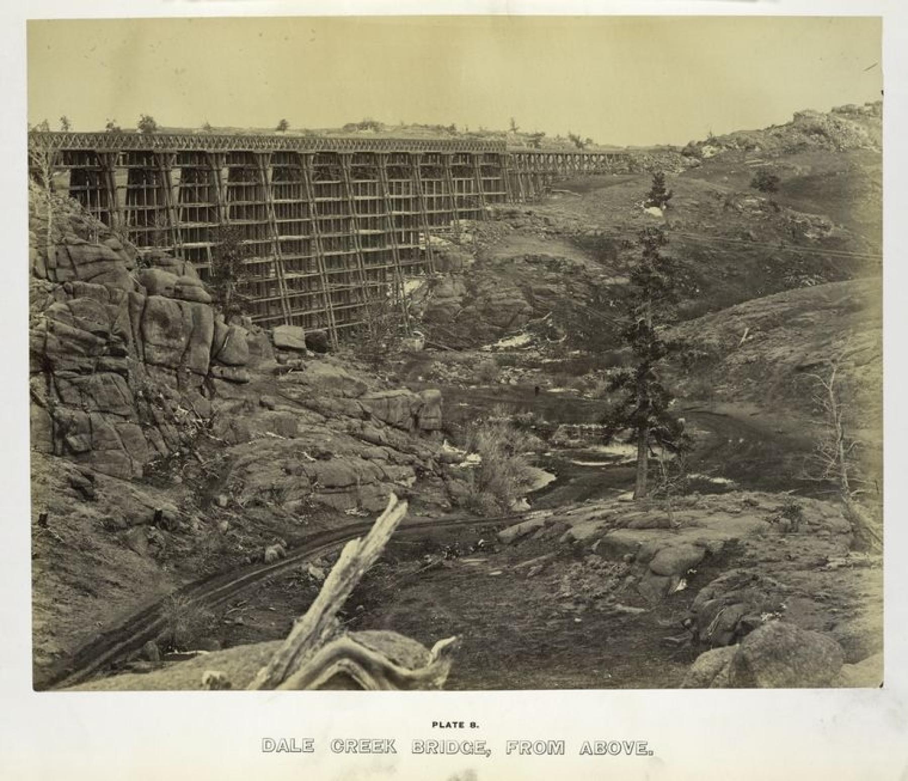
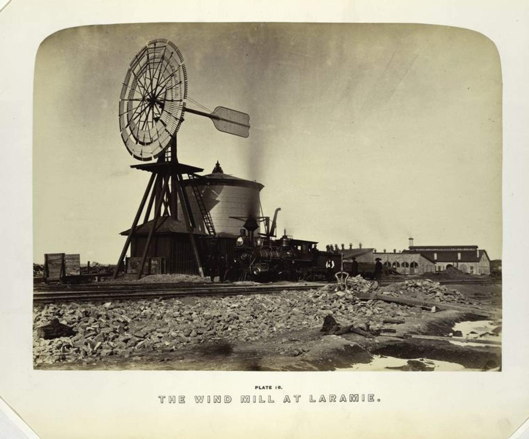
Railroad transportation made it possible for photographers to travel with speed to new locations like Cheyenne, Wyoming. The town was founded the year before, in November of 1867, with arrival of the tracks. The Union Pacific line was more than convenient for a number of photographers who documented construction and traveled on the completed line. Chief among these was Andrew J. Russell, a former army photographer, who spent 1868 to 1869 with the Union Pacific Railroad as it proceeded west. His prints were issued by the railroad in an elegant volume entitled The Great West (1869). Some also graced the pages of geologist F. V. Hayden’s Sun Pictures of Rocky Mountain Scenery (1870). This helped to set a new standard for the publication of photography in Wyoming Territory. Major expeditions exploring and documenting the geography and resources of the West were now accompanied by photographers as a matter of course. Reports and photographs from United States Geological Survey expeditions led by Hayden and others were published and widely distributed. William H. Jackson’s images of the Yellowstone country contributed significantly to Congressional perceptions of the region, resulting in establishment of our first national park.
Conclusion
With completion of the railroad, a vast number of people settled in Wyoming Territory, towns were established along the line, businesses flourished, and ranching and agriculture developed a strong foothold. Predictably, many photographers set up shop and provided their services and products to the growing Wyoming population. Indeed, from this time on, most towns of any size hosted citizen photographers focusing their lenses on people, homes, livestock, businesses, and landscapes. Ultimately, photography proliferated beyond imagination as technology and equipment improved and even everyday tourists and residents with Kodak cameras took their own pictures and used them to populate photo albums and boxes of family and community memories. It would require a huge flight of fantasy for people in the late 1800s to imagine more than a century later, that just about everyone would carry personal devices that served to create images that could be shared around the world in an instant. This essay does not pretend to identify all of the pre-territorial photographers active in what became Wyoming. More are to be identified, and perhaps some of the images taken by others and thought to be lost may become found.
[Editor’s note: Special thanks to the Wyoming Cultural Trust Fund for support that in part made this article possible.]
Acknowledgements
The author would like to thank historians Paula Fleming, Clint Gilchrist, Ephriam D. Dickson III, and the late John E. Carter for their scholarship and for sharing results of their research and writing.
Selected References
- Anderson, Nancy K., and Linda S. Ferber. Albert Bierstadt: Art & Enterprise. New York: Hudson Hill Press, 1990.
- Aspinwall, Jane. Alexander Gardner, The Western Photographs, 1867-1868. Kansas City: The Hall Family Foundation and the Nelson Gallery Foundation, 2014.
- Brown, Randy. "Attack on the Kelly-Larimer Wagon Train." Overland Journal 5, no. 1 (Winter 1987): 16-38.
- Carter, John E. “Photographing Across the Plains: Charles R. Savage in 1866.” Nebraska History 71 (1990): 58-63. “The Platte River Road in 1866: Charles Savage’s Visual Narrative.” Nebraska History 89 (2008): 132-141.
- Ephriam D. Dickson III, "Shadowy Figures About Whom Little is Known: Artists of the Simpson Expedition, 1858-59," Utah Historical Quarterly 83, no. 4 (Fall 2015): 270-289.
- Fleming, Paula. “Photographing the Plains Indians: Ridgway Glover at Forts Laramie and Phil Kearny, 1866.” In The People of the Buffalo: The Plains Indians of North America. Silent Memorials: Artifacts as Cultural and Historical Documents, Volume 2, edited by Colin F. Taylor and Hugh A. Dempsey. Eagle Butte, SD: Tatanka Press, 2005. https://www.flemingphotohistory.com/published-papers/photographing-the-indians-a/photographing-the-indians-a-index.htm.
- Fleming, Paula. “Photographing the Plains Indians: Ridgway Glover at Forts Laramie and Phil Kearny, 1866, Part II.” Paula Fleming’s Photographic History. Accessed November 12, 2025. https://www.flemingphotohistory.com/published-papers/photographing-the-indians-b/photographing-the-indians-b-index.htm.
- Frémont. J. C. Report of The Exploring Expedition to The Rocky Mountains in the Year 1842, and to Oregon and North California in the Years 1843-‘44. Washington: Gales and Seaton, Printers, 1845. HathiTrust Digital Library. https://babel.hathitrust.org/cgi/pt?id=hvd.hwwkey&seq=5
- Goetzmann, William H. Exploration and Empire, The Explorer and the Scientist in the Winning of the American West. New York: Alfred A. Knopf, 1967.
- Hayden, Dr. F. V. Ethnography and Philology of the Indian Tribes of the Missouri Valley. Philadelphia: C. Sherman & Son, Printers, 1862: 322. Internet Archive. https://archive.org/details/bp_1346547/page/323/mode/2up. Accessed February 1, 2023.
- Hebard, Grace Raymond. Statement of John Sublette of Elk Mountain, Wyoming relative to the early history of Wyoming. Conducted December 7, 1913. www.familysearch.org/library/books/viewer/347232/?offset=0#page=1&viewer=picture&o=info&n=0&q=. Accessed June 1, 2026.
- Jackson, Donald and Mary Lee Spence, editors. The Expeditions of John Charles Fremont, Volume 1, Travels from 1838 to 1844. Urbana: University of Illinois Press, 1970.
- Larimer, Sarah L. The Capture and Escape; or Life Among the Sioux. Philadelphia: Claxton, Remsen & Haffelfinger, 1870.
- Merrill, Marlene Deahl and Daniel D. Merrill, editors. Up the Winds and Over the Tetons, Journal Entries and Images from the 1860 Raynolds Expedition. Albuquerque: University of New Mexico Press, 2012.
- Murphy, David Royce. Scenery, Curiosities, and Stupendous Rocks, William Quesenbury’s Overland Sketches, 1850-1851. Norman: University of Oklahoma Press, 2011.
- Raynolds, W. F. Report on the Exploration of the Yellowstone River. Washington, D.C.: Government Printing Office, 1868. HathiTrust. https://babel.hathitrust.org/cgi/pt?id=mdp.39015011349597&view=1up&seq=7. Accessed February 1, 2023.
- Sandweiss, Martha A. Print the Legend, Photography and the American West. New Haven: Yale University Press, 2002.
- Spence, Clark and Mary Lee Spence, editors. Narrative of My Captivity Among the Sioux Indians, by Fanny Kelly. Old Saybrook, CT: Konecky & Konecky, 1990.
- Utley, Robert M., editor. An Army Doctor on the Western Frontier, Journals and Letters of John Vance Lauderdale, 1864-1890. Albuquerque: University of New Mexico Press, 2014.
Images
- John C. Fremont portrait by William Smith Jewett, NPG.72.17, National Portrait Gallery, Smithsonian Institution.
- Frémont. J. C. Report of The Exploring Expedition to The Rocky Mountains in the Year 1842, and to Oregon and North California in the Years 1843-‘44. Washington: Gales and Seaton, Printers, 1845. HathiTrust Digital Library.
- Omaha World Herald-Quesenbury Sketchbook Collection, Omaha World Herald, Nebraska State Historical Society
- Jones, Wesley John. Amusing and thrilling adventures of a California artist. Boston: Self Published, 1854. Yale University, Beinecke Rare Book and Manuscript Library
- Burr, David Auguste. Soldiers and wood wagon at Fort Bridger, 1857-1858. Church History Library, The Church of Jesus Christ of Latter-day Saints.
- Mills, Samuel C. and Edward Jagiello. Fort Laramie, 1858. National Archives and Records Administration.
- Mills, Samuel C. and Edward Jagiello. Near Fort Laramie and Devil’s Gate, Summer 1858. Library of Congress.
- Hutton, James D. “Laramie Hills,” 1859-1860. Beinecke Rare Book and Manuscript Library, Yale University.
- Hutton, James D. Salted paper print of Arapaho Chiefs, 1859. London, British Museum.
- Hutton, James D. Salted paper print of Upper Platte Indian Agency, 1859. London, British Museum.
- Hayden, Dr. F. V. Ethnography and Philology of the Indian Tribes of the Missouri Valley. Philadelphia: C. Sherman & Son, Printers, 1862: 322. Internet Archive.
- A stereoscopic camera collodion, circa 1860. Reference: #9727 Courtesy Foticos Collection (Spain). Accessed September 28, 2026: https://foticoscollection.com/en/item/stereo-camera-to-the-collodion/97…
- Bierstadt, Albert. “Ogalillah Sioux Village, North fork of the Platte, Na.” 1859. Nebraska State Historical Society.
- Bierstadt, Albert. “Shoshone Warrior,” 1859. RG3122.PH Nebraska State Historical Society.
- Bierstadt, Albert. Emigrant train at the Big Sandy, 1859. Sublette County Historical Society.
- Larimer, Sarah. The Capture and Escape or Life Among the Sioux, 1870. Internet Archive.
- Moellman, Charles. Carte de visite drawing of Fort Laramie. Courtesy of the author’s collection.
- Wayman St. Clair, Company G, 11th Ohio Volunteer Cavalry. Bretney Collection C-1654/25810. Wyoming State Archives, Wyoming State Parks and Cultural Resources.
- Glover, Ridgeway, Commissioners who participated in the 1866 Fort Laramie treaty negotiations. Larry Ness collection.
- Russell, Andrew J. “Dale Creek Bridge, from Above,” October 1868. Published in The Great West, 1869. The New York Public Library Digital Collections.
- Russell, Andrew J. “The Wind Mill at Laramie.” Published in The Great West, 1869. The New York Public Library Digital Collections.